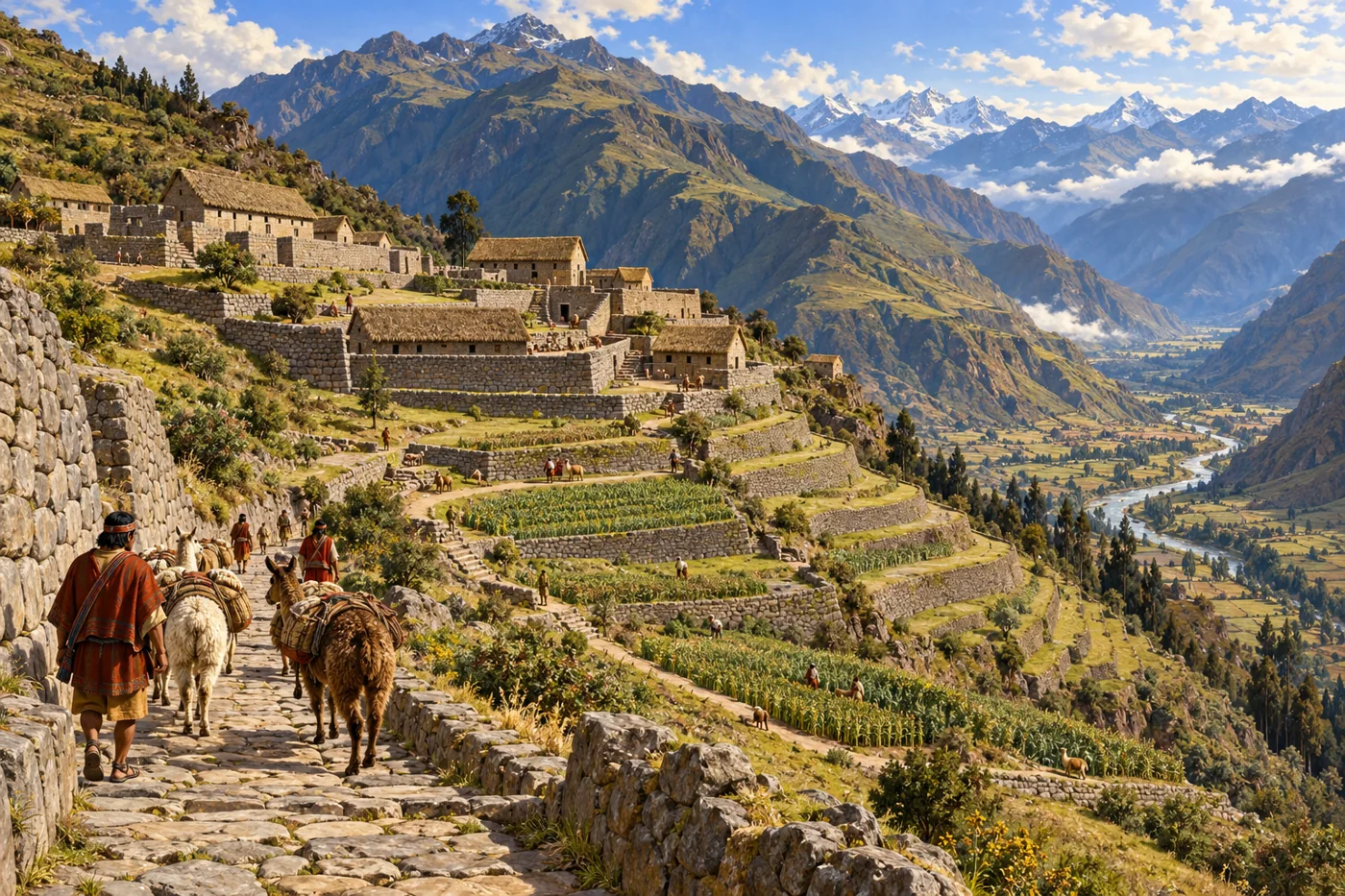
AI-generated historical reconstruction. Andean Inca settlement and terraced valley around AD1500. People, buildings and details are imagined; this is not a verified archaeological plan, likeness or eyewitness record.
The Incas built an empire along the Andes of South America during the fifteenth and early sixteenth centuries. From Cusco, in present-day Peru, their rulers connected many peoples through roads, farming, labour and military power. They called this state Tawantinsuyu, the four regions together. Its story reaches beyond famous ruins: it belongs to the communities who sustained it, resisted its rulers and carried Andean knowledge through conquest into the present.
Historical dates and route context
A connected thematic history, not the itinerary of a single traveller. Early ruler chronologies are conventional and archaeological dates are approximate; thematic day/month anchors are editorial. Modern countries orient the viewer and are not Inca borders. Existing territory snapshots are schematic political footprints, not uniform control, ethnic boundaries or road geometry. No empire-wide population total is asserted. Reconstructions are labelled AI-generated; imagined people are not verified portraits. Living Andean peoples are distinct from the historical imperial state.
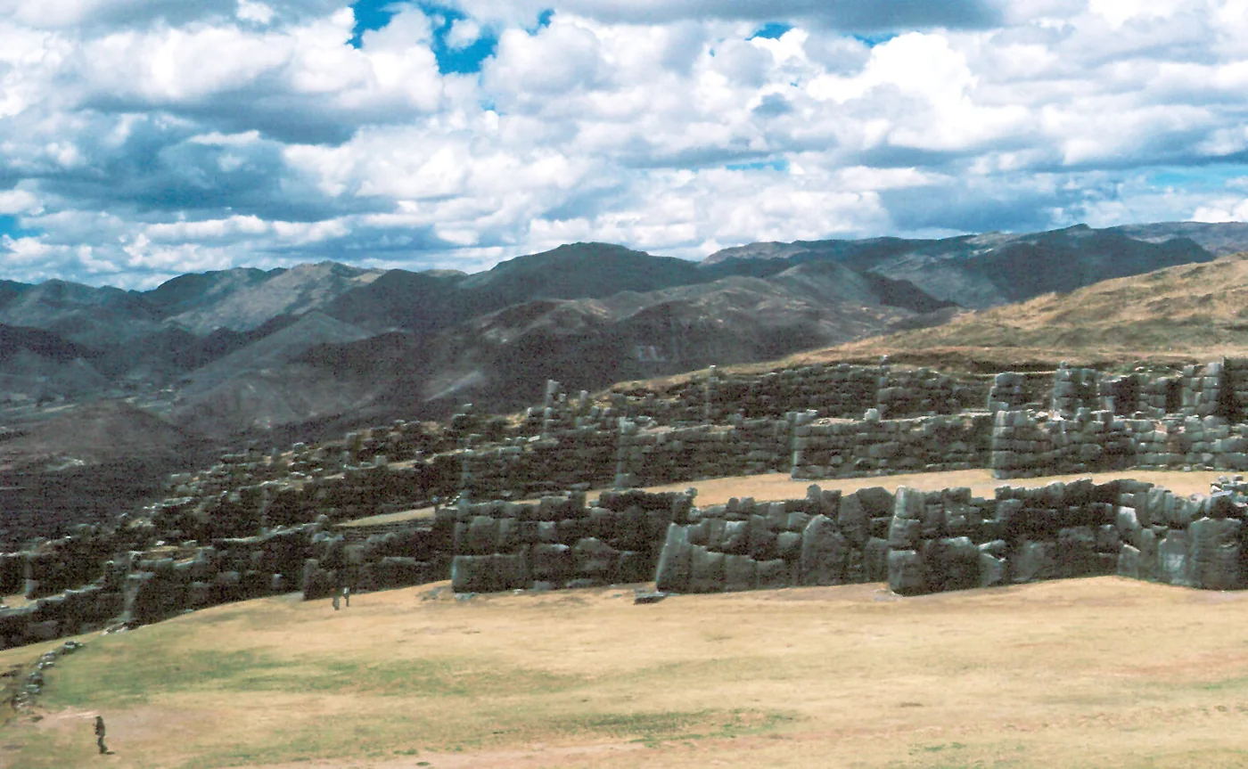
Modern photograph. Surviving stone walls at Sacsayhuamán above Cusco, photographed in modern times. Photo: Wolfgangbeyer / Wikimedia Commons · CC BY-SA 3.0. Resized and converted to WebP.
Cusco was not built in an empty landscape. Its valley had a long history before the Inca kingdom emerged around the thirteenth century. Later accounts preserve sacred origin traditions, while archaeology reveals generations of settlement and change. In the fifteenth century, the ruler Pachacuti reshaped the capital and expanded its power. Carefully fitted stonework, religious compounds and royal residences expressed a new political order. The conventional date fourteen thirty-eight helps organize this history, but the early sequence of rulers is less certain than a modern calendar suggests.
Historical dates and route context
A connected thematic history, not the itinerary of a single traveller. Early ruler chronologies are conventional and archaeological dates are approximate; thematic day/month anchors are editorial. Modern countries orient the viewer and are not Inca borders. Existing territory snapshots are schematic political footprints, not uniform control, ethnic boundaries or road geometry. No empire-wide population total is asserted. Reconstructions are labelled AI-generated; imagined people are not verified portraits. Living Andean peoples are distinct from the historical imperial state.
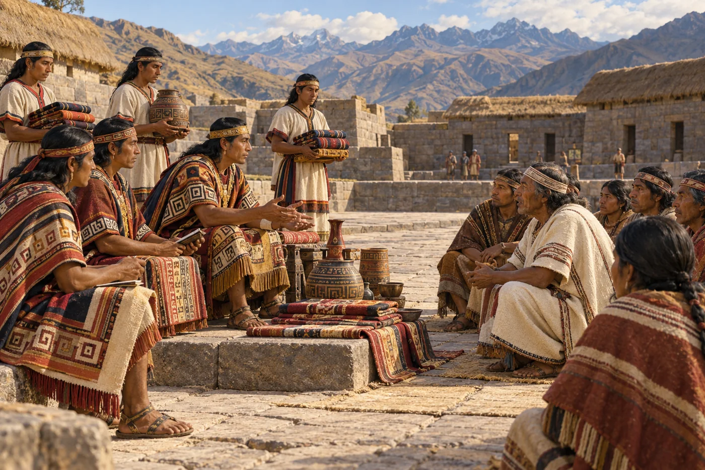
AI-generated historical reconstruction. Anonymous Inca envoys and Andean community leaders negotiating around AD1480. People, buildings and details are imagined; this is not a verified archaeological plan, likeness or eyewitness record.
Pachacuti and his successors extended their authority far beyond the capital. Tupac Inca Yupanqui led campaigns north and south; later, Huayna Capac brought the state to its widest reach. Expansion combined force with negotiation and drew on societies already skilled in farming, building and exchange. Conquered communities did not become a single people. Local leaders and traditions endured, while rulers demanded resources and service. At Ingapirca, in the northern Andes, earlier Cañari heritage and later Inca construction share one place. The empire joined different histories, often on unequal terms.
Historical dates and route context
A connected thematic history, not the itinerary of a single traveller. Early ruler chronologies are conventional and archaeological dates are approximate; thematic day/month anchors are editorial. Modern countries orient the viewer and are not Inca borders. Existing territory snapshots are schematic political footprints, not uniform control, ethnic boundaries or road geometry. No empire-wide population total is asserted. Reconstructions are labelled AI-generated; imagined people are not verified portraits. Living Andean peoples are distinct from the historical imperial state.
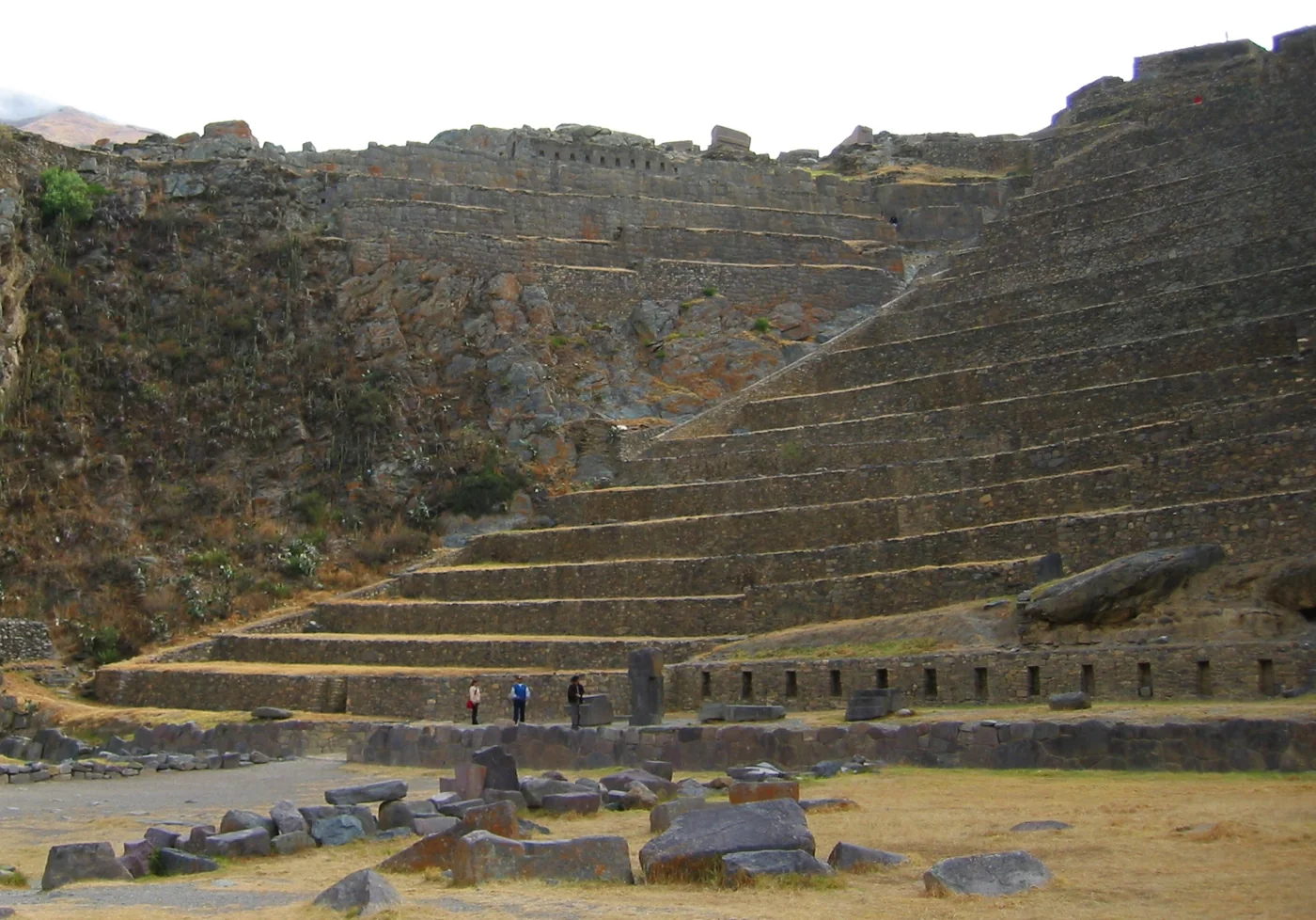
Modern photograph. Ollantaytambo’s surviving stone terraces, photographed in 2003. Photo: Bcasterline / Wikimedia Commons · Public domain. Resized and converted to WebP.
Behind imperial power lay work in fields and households. At the Ollantaytambo archaeological complex, terraces and water channels show how builders adapted steep ground for cultivation. Retaining walls and drainage helped manage erosion, drawing on much older Andean knowledge. Families grew crops suited to different elevations: maize in favourable valleys, potatoes higher up, and quinoa, whose small seeds could be cooked for meals. Diets varied across the empire. Coastal communities ate seafood, while some households raised guinea pigs for meat; llamas also provided meat. These were not identical meals eaten by everyone. The state required rotating labour service, called mit’a, for fields, roads and other tasks. Community skill fed people, while imperial obligations added heavy demands.
Historical dates and route context
A connected thematic history, not the itinerary of a single traveller. Early ruler chronologies are conventional and archaeological dates are approximate; thematic day/month anchors are editorial. Modern countries orient the viewer and are not Inca borders. Existing territory snapshots are schematic political footprints, not uniform control, ethnic boundaries or road geometry. No empire-wide population total is asserted. Reconstructions are labelled AI-generated; imagined people are not verified portraits. Living Andean peoples are distinct from the historical imperial state.
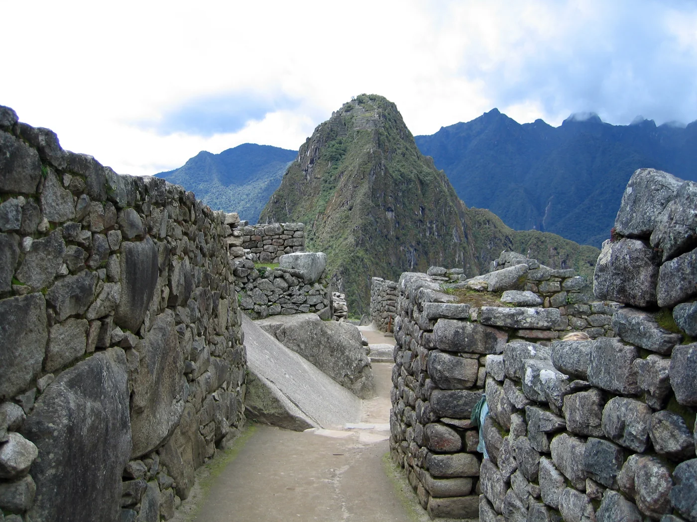
Modern photograph. Surviving masonry at Machu Picchu, photographed in modern times; a view of the archaeological remains, not their original occupied appearance. Photo: Entropy1963 / Wikimedia Commons · Public domain. Resized and converted to WebP.
Above a river bend, Machu Picchu brings stone buildings, terraces and managed water into a steep mountain setting. It is usually interpreted as a royal estate associated with Pachacuti, rather than the capital of the empire. Its creation depended on skilled builders and the labour of people who supported the household and its rituals. Archaeology can also revise the written chronology. Radiocarbon measurements published in twenty twenty-one point to occupation beginning around fourteen twenty, earlier than the familiar construction date of fourteen fifty. That does not date every wall, but it changes the questions historians ask.
Historical dates and route context
A connected thematic history, not the itinerary of a single traveller. Early ruler chronologies are conventional and archaeological dates are approximate; thematic day/month anchors are editorial. Modern countries orient the viewer and are not Inca borders. Existing territory snapshots are schematic political footprints, not uniform control, ethnic boundaries or road geometry. No empire-wide population total is asserted. Reconstructions are labelled AI-generated; imagined people are not verified portraits. Living Andean peoples are distinct from the historical imperial state.
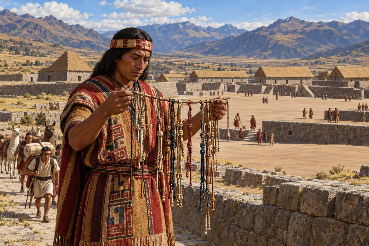
AI-generated historical reconstruction. An anonymous khipu official and caravan at Huánuco Pampa around AD 1500. People, architecture and details are illustrative, not a verified site reconstruction or eyewitness record.
The roads linked mountain settlements with valleys, deserts and the coast. At Huánuco Pampa, a planned administrative centre, a great plaza and rows of storehouses made state organization visible. Supplies included food and textiles. People wore garments woven from cotton or the fibres of llamas and alpacas. Men commonly wore sleeveless tunics and mantles; women wore wrapped dresses secured with belts and shawls. Materials, patterns and quality could express identity and rank. Fine cloth also served as a diplomatic gift and a demand of imperial government. Officials recorded obligations with khipus, arrangements of cords and knots. Messengers carried information, while people and llama caravans moved goods. These roads carried support and communication, but also the coercion of imperial rule.
Historical dates and route context
A connected thematic history, not the itinerary of a single traveller. Early ruler chronologies are conventional and archaeological dates are approximate; thematic day/month anchors are editorial. Modern countries orient the viewer and are not Inca borders. Existing territory snapshots are schematic political footprints, not uniform control, ethnic boundaries or road geometry. No empire-wide population total is asserted. Reconstructions are labelled AI-generated; imagined people are not verified portraits. Living Andean peoples are distinct from the historical imperial state.
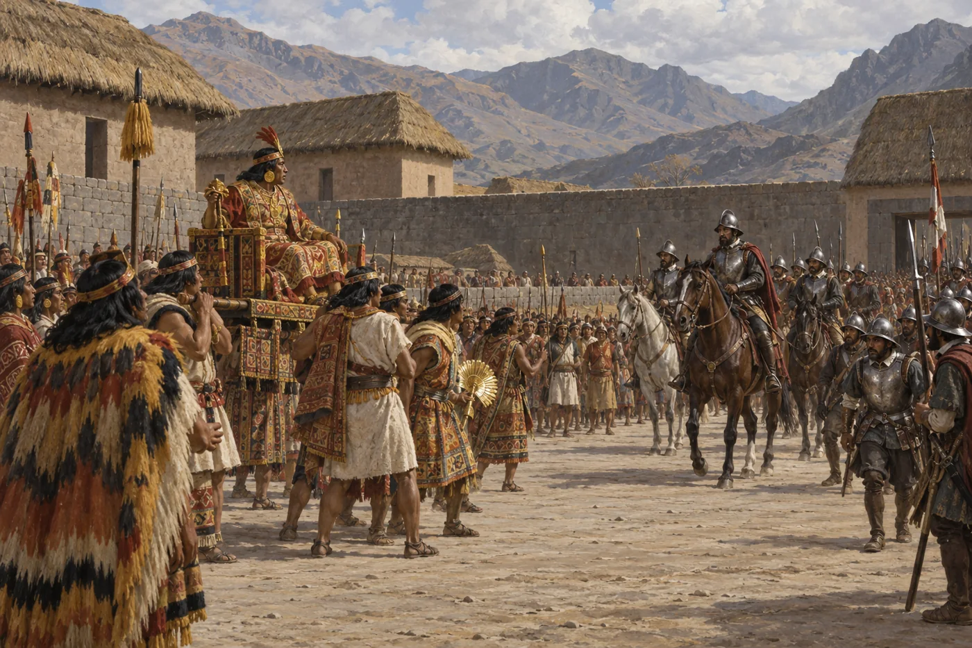
AI-generated historical reconstruction. Illustrative, non-graphic interpretation of the encounter and capture at Cajamarca in 1532. The ruler is an imagined likeness; the composition is not an eyewitness record.
By fifteen thirty-two, disease and a struggle between the rulers Atahualpa and Huascar had shaken the empire. Atahualpa won that civil war as Francisco Pizarro’s expedition arrived. At Cajamarca, on the sixteenth of November, Spanish forces ambushed his entourage and captured him. His captivity did not immediately place every Andean community under Spanish control. Indigenous allies, opponents and competing ambitions shaped what followed. Despite the collection of a great ransom, the Spanish executed Atahualpa the next year. The roads that had connected the empire now also helped the invaders move through it.
Historical dates and route context
A connected thematic history, not the itinerary of a single traveller. Early ruler chronologies are conventional and archaeological dates are approximate; thematic day/month anchors are editorial. Modern countries orient the viewer and are not Inca borders. Existing territory snapshots are schematic political footprints, not uniform control, ethnic boundaries or road geometry. No empire-wide population total is asserted. Reconstructions are labelled AI-generated; imagined people are not verified portraits. Living Andean peoples are distinct from the historical imperial state.
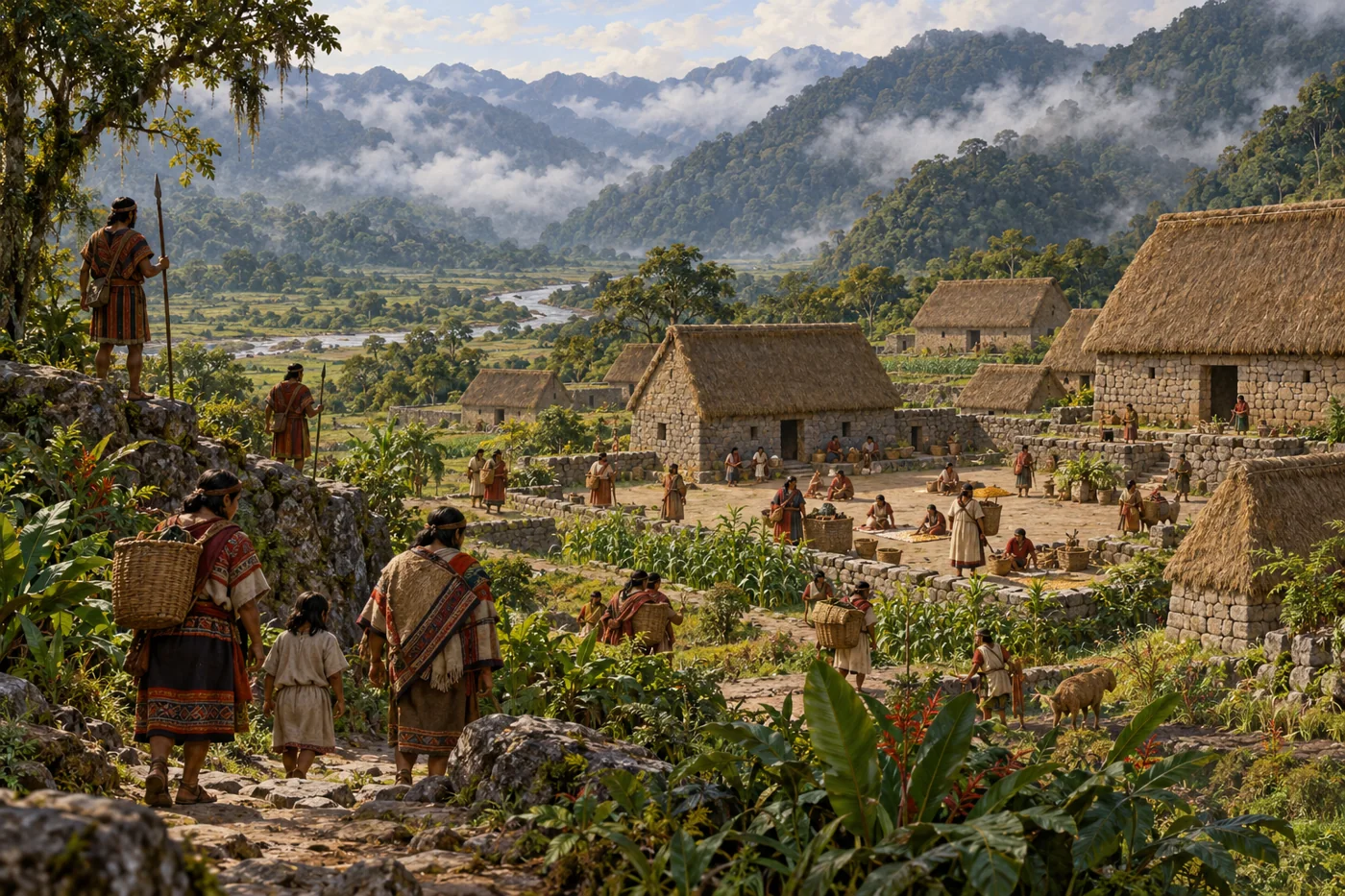
AI-generated historical reconstruction. Illustrative refuge settlement in the Espíritu Pampa–Vilcabamba region around AD 1560. People and buildings are imagined, not a verified site plan or eyewitness record.
Resistance continued after the occupation of the imperial capital. Manco Inca led a major uprising in fifteen thirty-six, and an independent Inca state survived in the forested Vilcabamba region. The ruins now called Espíritu Pampa are associated with its later capital, far from Machu Picchu’s celebrated ridge. This was a reduced refuge, not the old empire still ruling the Andes. In fifteen seventy-two, Spanish forces ended that independent state. Colonial rule brought dispossession, religious pressure and dangerous forced labour. Yet communities adapted and resisted; the fall of a court did not erase the people who had lived under it.
Historical dates and route context
A connected thematic history, not the itinerary of a single traveller. Early ruler chronologies are conventional and archaeological dates are approximate; thematic day/month anchors are editorial. Modern countries orient the viewer and are not Inca borders. Existing territory snapshots are schematic political footprints, not uniform control, ethnic boundaries or road geometry. No empire-wide population total is asserted. Reconstructions are labelled AI-generated; imagined people are not verified portraits. Living Andean peoples are distinct from the historical imperial state.
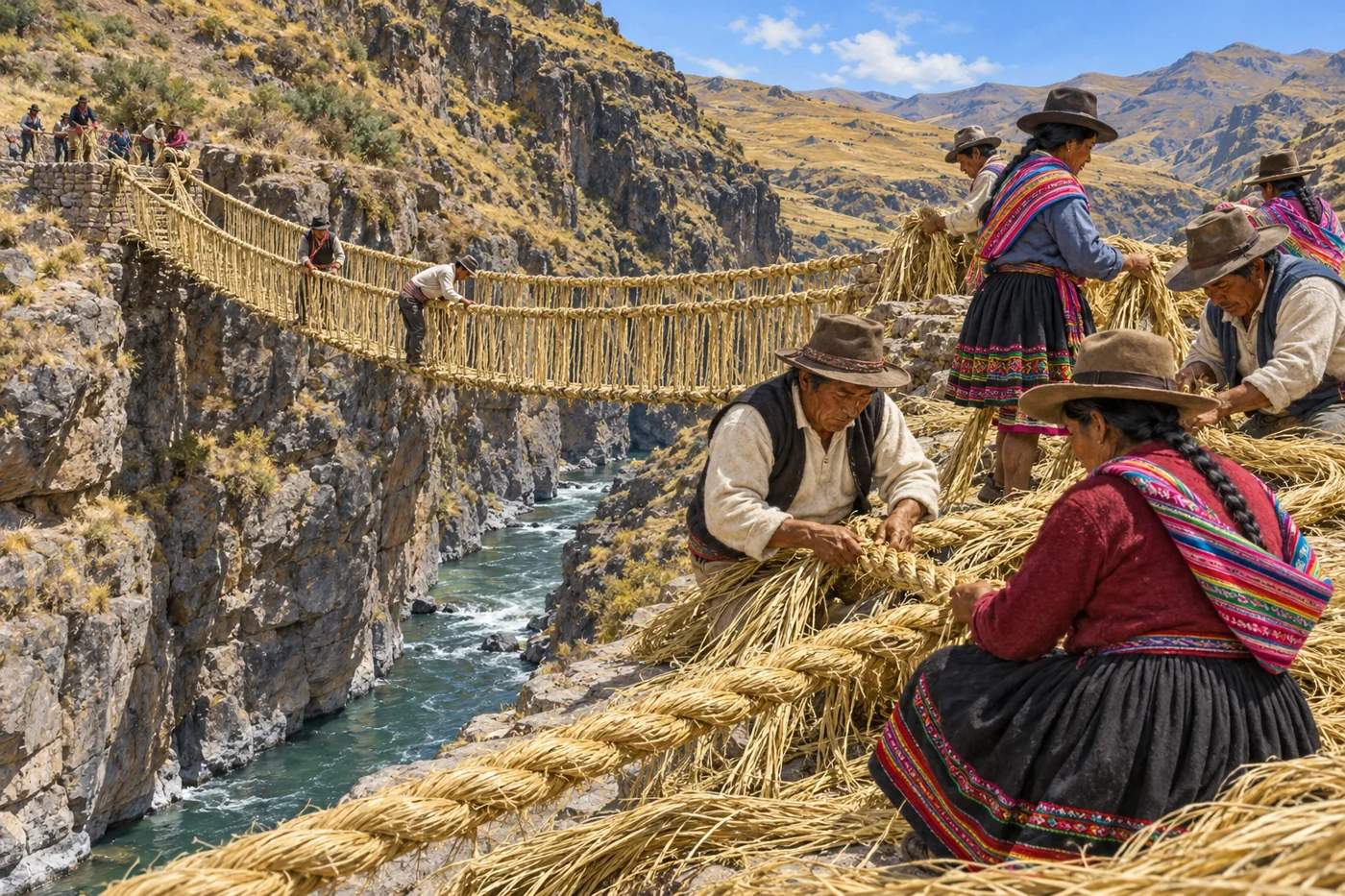
AI-generated modern cultural illustration. Anonymous Quechua community craftspeople renewing the Q'eswachaka grass-rope bridge. This depicts a living tradition, not an archival photograph or verified portraits.
At Q’eswachaka, Quechua-speaking communities renew a grass-rope bridge over the Apurimac River. Families prepare fibres, specialists guide the weaving, and shared work carries knowledge between generations. This is a living tradition, not an ancient bridge preserved unchanged. Quechua, Aymara and other Andean communities have their own continuing histories; they are not simply remnants of an empire. Looking back across the capital, cultivated slopes, road centres and forest refuge, one connection remains: these places were made and maintained by people. Their knowledge helps us understand the Inca past without ending the story at conquest.
Historical dates and route context
A connected thematic history, not the itinerary of a single traveller. Early ruler chronologies are conventional and archaeological dates are approximate; thematic day/month anchors are editorial. Modern countries orient the viewer and are not Inca borders. Existing territory snapshots are schematic political footprints, not uniform control, ethnic boundaries or road geometry. No empire-wide population total is asserted. Reconstructions are labelled AI-generated; imagined people are not verified portraits. Living Andean peoples are distinct from the historical imperial state.