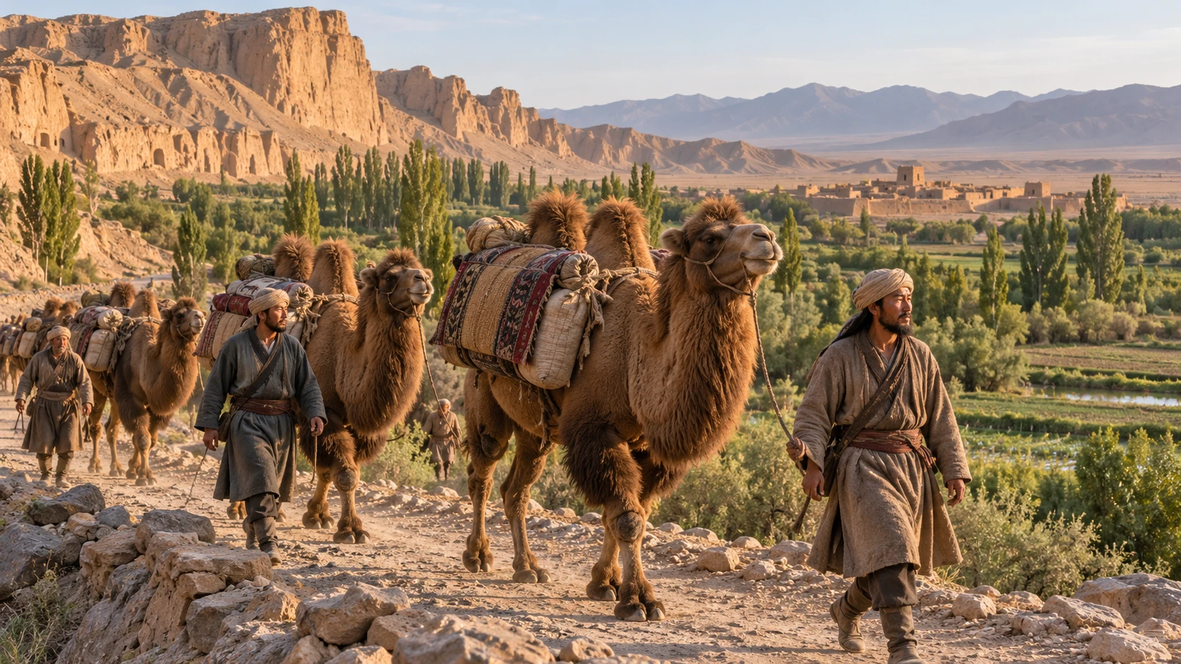
AI-generated historical reconstruction · representative Silk Road caravan around 800 CE, not a documented expedition.
The Silk Road was a web of trade routes linking China, Central Asia and lands farther west for many centuries. Merchants carried silk, horses, glass and other goods, while travellers shared religions, skills and stories. Most traders covered only part of the distance, passing cargo to others. Around the year 800, we will follow one representative chain of connections from Chang’an, today Xi’an, to Baghdad. Across deserts, mountain passes and trading cities, the journey reveals how distant societies depended on one another.
Historical dates and route context
Representative overland relay network around 800 CE, not a documented caravan or one continuously operated service. Dates and hours are editorial sequence markers, not known departures, arrivals or transit times. Routes are reconstructed corridors via the Hexi Corridor, northern Tarim oases, Irkeshtam–Alay–Fergana and Khurasan; they are not surveyed ancient tracks. Sary Tash labels a modern geographic anchor for the Alay Valley, not a claimed medieval town stop. Cargo, traders and animals change between legs. Modern national outlines do not depict political borders in 800.
Mogao caves and manuscripts · Aurel Stein, 1907 · public domain. Later archaeological photograph, not a view from 800.
Dunhuang lies ahead, where the green corridor narrows towards the deserts of western China. Leaving Chang’an means leaving a great capital of the Tang dynasty, whose courts and markets have welcomed people and fashions from distant lands. Beyond farms and fortified settlements, water becomes the most precious supply. At Dunhuang, travellers can rest and prepare for the next stage. Nearby, Buddhist cave shrines preserve another kind of traffic: sacred stories and artistic traditions carried across Asia.
Historical dates and route context
Representative overland relay network around 800 CE, not a documented caravan or one continuously operated service. Dates and hours are editorial sequence markers, not known departures, arrivals or transit times. Routes are reconstructed corridors via the Hexi Corridor, northern Tarim oases, Irkeshtam–Alay–Fergana and Khurasan; they are not surveyed ancient tracks. Sary Tash labels a modern geographic anchor for the Alay Valley, not a claimed medieval town stop. Cargo, traders and animals change between legs. Modern national outlines do not depict political borders in 800.
Kizil Buddhist painting · reproduction published by Albert von Le Coq, 1922 · public domain. Evidence of the region’s earlier Buddhist art.
Kucha approaches along the northern edge of the Tarim Basin. Crossing this region depends on a chain of oases rather than a march straight across the sands. Irrigation supports fields, food and settlements beneath the mountains. In the nearby Kizil caves, Buddhist paintings show how religious life could flourish beside these connections. The people tending canals and supplying travellers are as essential to the long-distance trade as the merchants carrying expensive cargo.
Historical dates and route context
Representative overland relay network around 800 CE, not a documented caravan or one continuously operated service. Dates and hours are editorial sequence markers, not known departures, arrivals or transit times. Routes are reconstructed corridors via the Hexi Corridor, northern Tarim oases, Irkeshtam–Alay–Fergana and Khurasan; they are not surveyed ancient tracks. Sary Tash labels a modern geographic anchor for the Alay Valley, not a claimed medieval town stop. Cargo, traders and animals change between legs. Modern national outlines do not depict political borders in 800.
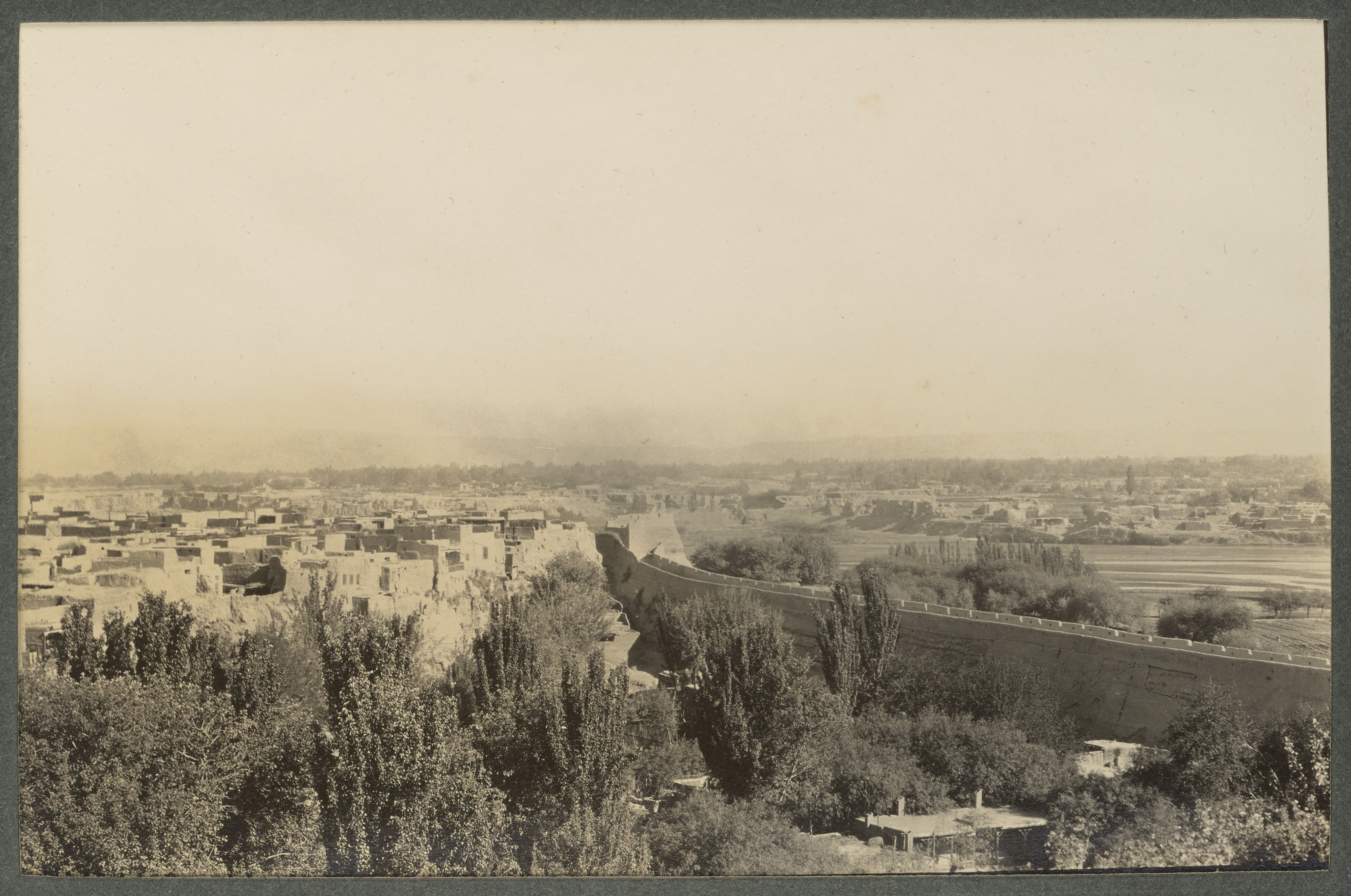
Kashgar · Percy Sykes, 1915 · public domain. Later historical city photograph, not a view from 800.
At Kashgar, routes around the desert meet roads leading into the mountains. A merchant reaching this oasis might sell a consignment, buy fresh supplies or entrust goods to someone who knows the next stretch. A bale of silk can travel farther than any one person accompanying it. Languages, prices and expectations change from market to market. The next challenge lies westward, where valleys and passes guide the way between high mountain ranges.
Historical dates and route context
Representative overland relay network around 800 CE, not a documented caravan or one continuously operated service. Dates and hours are editorial sequence markers, not known departures, arrivals or transit times. Routes are reconstructed corridors via the Hexi Corridor, northern Tarim oases, Irkeshtam–Alay–Fergana and Khurasan; they are not surveyed ancient tracks. Sary Tash labels a modern geographic anchor for the Alay Valley, not a claimed medieval town stop. Cargo, traders and animals change between legs. Modern national outlines do not depict political borders in 800.
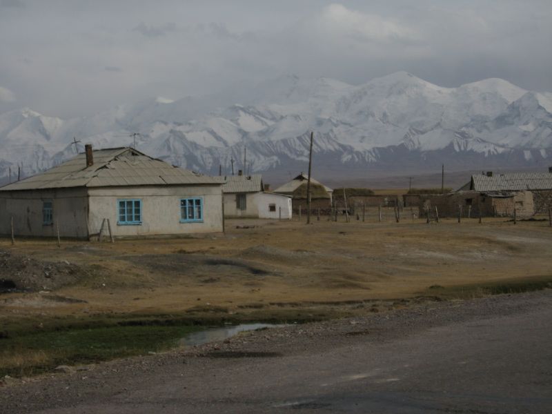
Alay Valley at Sary Tash · Robert Thomson, 2006 · CC BY 2.0. Modern geographical context; houses are not medieval.
Ahead lies the Alay Valley, reached through the mountain country west of Kashgar. The desert has given way to steep approaches, exposed ground and the danger of sudden cold. Guides, pack animals and knowledge of seasonal conditions matter more than the shortest line across a map. Beyond the high country, routes descend towards the fertile Fergana region. Every change of landscape reshapes the work of travel, from finding water to choosing when it is safe to move.
Historical dates and route context
Representative overland relay network around 800 CE, not a documented caravan or one continuously operated service. Dates and hours are editorial sequence markers, not known departures, arrivals or transit times. Routes are reconstructed corridors via the Hexi Corridor, northern Tarim oases, Irkeshtam–Alay–Fergana and Khurasan; they are not surveyed ancient tracks. Sary Tash labels a modern geographic anchor for the Alay Valley, not a claimed medieval town stop. Cargo, traders and animals change between legs. Modern national outlines do not depict political borders in 800.
Street in Samarkand · Sergei Prokudin-Gorskii, 1905–1915 · public domain. Later city view, not its appearance in 800.
Samarkand awaits beyond the mountain routes and fertile valleys. For centuries this region has been home to Sogdian merchants whose far-reaching communities helped connect the cities of Central Asia with China and other lands. Their letters and art reveal a world larger than any single kingdom. Around 800, political power and religious life are changing, yet the city remains a meeting place. Here, trade depends on relationships: people able to negotiate, translate and trust partners far from home.
Historical dates and route context
Representative overland relay network around 800 CE, not a documented caravan or one continuously operated service. Dates and hours are editorial sequence markers, not known departures, arrivals or transit times. Routes are reconstructed corridors via the Hexi Corridor, northern Tarim oases, Irkeshtam–Alay–Fergana and Khurasan; they are not surveyed ancient tracks. Sary Tash labels a modern geographic anchor for the Alay Valley, not a claimed medieval town stop. Cargo, traders and animals change between legs. Modern national outlines do not depict political borders in 800.
Bukhara’s Ark entrance · Sergei Prokudin-Gorskii, 1907 · public domain. Later architecture and photograph, not an 800 reconstruction.
Bukhara lies farther west, surrounded by an oasis that supports its urban life. A trading city needs grain, water, workshops and local customers as well as distant buyers of luxuries. Craftspeople turn raw materials into goods worth carrying onwards; households supply food and shelter to visitors. The famous monuments standing here today belong largely to later centuries. This earlier Bukhara is already part of a much older pattern: cities growing where agriculture and long-distance exchange sustain one another.
Historical dates and route context
Representative overland relay network around 800 CE, not a documented caravan or one continuously operated service. Dates and hours are editorial sequence markers, not known departures, arrivals or transit times. Routes are reconstructed corridors via the Hexi Corridor, northern Tarim oases, Irkeshtam–Alay–Fergana and Khurasan; they are not surveyed ancient tracks. Sary Tash labels a modern geographic anchor for the Alay Valley, not a claimed medieval town stop. Cargo, traders and animals change between legs. Modern national outlines do not depict political borders in 800.
Greater Kyz Kala, Merv · Dr. Alexey Yakovlev, 2019 · CC BY-SA 2.0. Present-day remains with a long building history.
Merv comes into view after the river crossings and dry country west of Bukhara. Its oasis makes a major settlement possible on the edge of the desert. Roads branch towards Iran, Central Asia and lands to the south. Merv’s history is also political: the Abbasid movement that transformed the Islamic empire drew crucial support from Khurasan in the eighth century. Traders arrive in a region where the fortunes of cities, armies and ruling families are closely entangled.
Historical dates and route context
Representative overland relay network around 800 CE, not a documented caravan or one continuously operated service. Dates and hours are editorial sequence markers, not known departures, arrivals or transit times. Routes are reconstructed corridors via the Hexi Corridor, northern Tarim oases, Irkeshtam–Alay–Fergana and Khurasan; they are not surveyed ancient tracks. Sary Tash labels a modern geographic anchor for the Alay Valley, not a claimed medieval town stop. Cargo, traders and animals change between legs. Modern national outlines do not depict political borders in 800.
Cheshmeh-Ali, Ray · Orijentolog, 2012 · CC BY-SA 3.0. Modern landscape; visible structures and reliefs are not presented as eighth-century.
Ray lies ahead near the southern slopes of the Alborz Mountains, beside present-day Tehran. Across the Iranian plateau, routes connect cities separated by long stretches of dry country. Travellers need reliable places to obtain provisions, information and fresh animals. Goods entering a workshop or market here may acquire new uses and meanings. The same exchanges can carry unfamiliar techniques and beliefs, changed by the people who receive them. Westward, the road leads across mountain country towards Mesopotamia.
Historical dates and route context
Representative overland relay network around 800 CE, not a documented caravan or one continuously operated service. Dates and hours are editorial sequence markers, not known departures, arrivals or transit times. Routes are reconstructed corridors via the Hexi Corridor, northern Tarim oases, Irkeshtam–Alay–Fergana and Khurasan; they are not surveyed ancient tracks. Sary Tash labels a modern geographic anchor for the Alay Valley, not a claimed medieval town stop. Cargo, traders and animals change between legs. Modern national outlines do not depict political borders in 800.
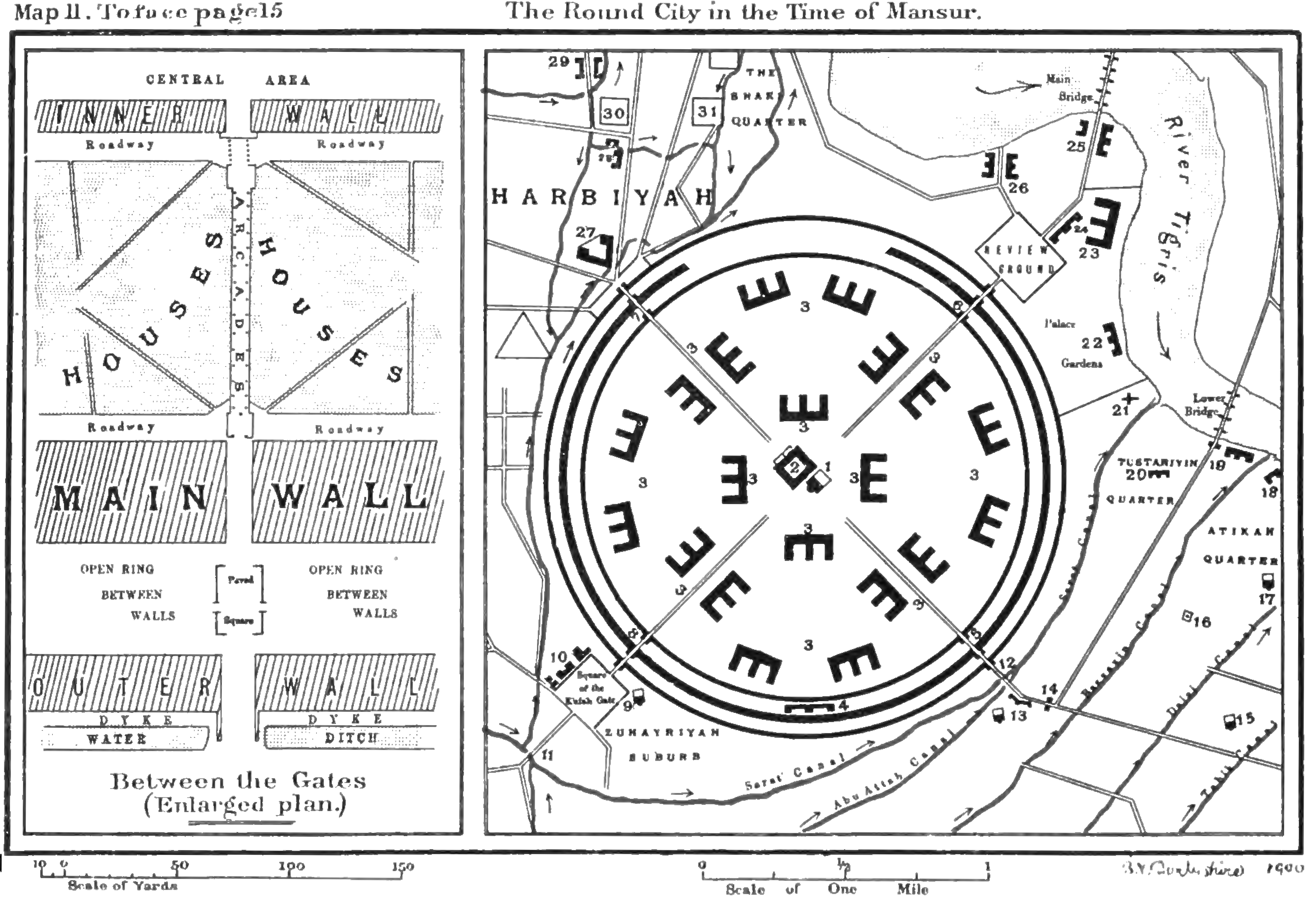
Baghdad’s Round City · Guy Le Strange, 1900 · public domain. Retrospective historical plan, not a contemporary map.
Baghdad is the destination ahead, beside the Tigris in Mesopotamia. Founded in 762 as the Abbasid capital, it is still a young city around the year 800. Its position connects overland traffic with river transport and routes towards the Persian Gulf. Goods arriving from the east enter an urban world of rulers, workers, merchants and scholars. The journey does not end at a single gate: a city this connected gathers supplies and ideas from many directions.
Historical dates and route context
Representative overland relay network around 800 CE, not a documented caravan or one continuously operated service. Dates and hours are editorial sequence markers, not known departures, arrivals or transit times. Routes are reconstructed corridors via the Hexi Corridor, northern Tarim oases, Irkeshtam–Alay–Fergana and Khurasan; they are not surveyed ancient tracks. Sary Tash labels a modern geographic anchor for the Alay Valley, not a claimed medieval town stop. Cargo, traders and animals change between legs. Modern national outlines do not depict political borders in 800.
Chinese camel tomb figure · The Metropolitan Museum of Art, 30.76.71 · CC0. Museum object illustrating the camel’s place in material culture.
From China to Baghdad, the Silk Road has carried far more than silk. Its connections depend on farmers maintaining water supplies, guides knowing the passes, artisans making desirable goods and merchants arranging the next exchange. No single caravan or empire owns the whole story. Beyond Baghdad, other routes continue towards the Mediterranean and the sea. What joins these distant places is a succession of human encounters, through which objects, knowledge and beliefs can travel much farther than the people who first set them in motion.
Historical dates and route context
Representative overland relay network around 800 CE, not a documented caravan or one continuously operated service. Dates and hours are editorial sequence markers, not known departures, arrivals or transit times. Routes are reconstructed corridors via the Hexi Corridor, northern Tarim oases, Irkeshtam–Alay–Fergana and Khurasan; they are not surveyed ancient tracks. Sary Tash labels a modern geographic anchor for the Alay Valley, not a claimed medieval town stop. Cargo, traders and animals change between legs. Modern national outlines do not depict political borders in 800.