HISTORICAL STORY

Amazonia · Nations Beneath the Forest

A long human history · societies, landscapes and discoveries

▶ Play on the map

A forest shaped by people

Amazonia · a long human history
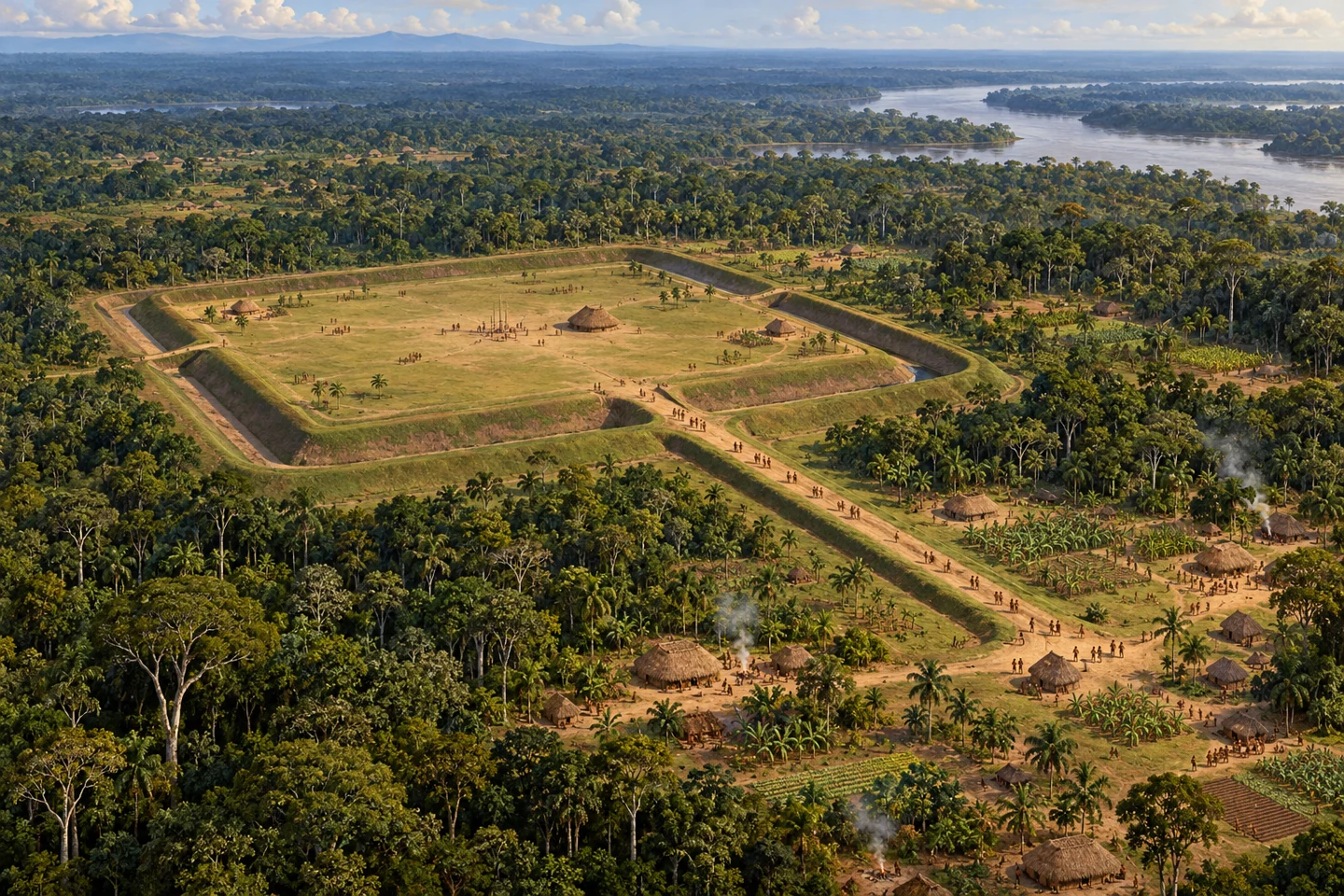
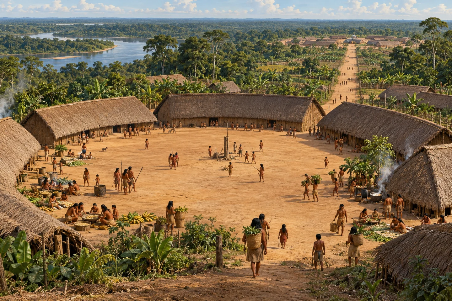
Illustrative view of an Aquiry earthwork landscape around AD 200.
AI-generated historical reconstruction. Illustrative view of an Aquiry earthwork landscape around AD 200. The composition, people and buildings are imagined; this is not an exact site reconstruction or eyewitness record.

Amazonia is the great river and forest region of northern South America, and its forests have a long human history. For thousands of years, Indigenous peoples have cultivated plants, built communities and passed on knowledge of land and water. Earthworks and roads now reveal parts of that history on a remarkable scale. We will follow several societies through time, then see how different archaeological discoveries are joining into a larger picture.

Historical dates and route context

Dates locate broad historical periods unless a research publication is identified. Map labels show approximate cultural periods, including earlier and later occupations for comparison; they are retrospective context, not claims that all sites were occupied on this date. Modern borders are not ancient political boundaries.

Sources: University of Helsinki: Aquiry communities, chronology and environmental legacy · Clement et al. (2015): The domestication of Amazonia before European conquest · Rostain et al., Science (2024): Two thousand years of garden urbanism · Prümers et al., Nature (2022): low-density urbanism in Casarabe culture · Heckenberger et al., Science (2008): Pre-Columbian urbanism in Amazonia
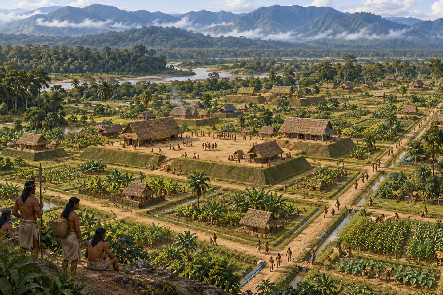
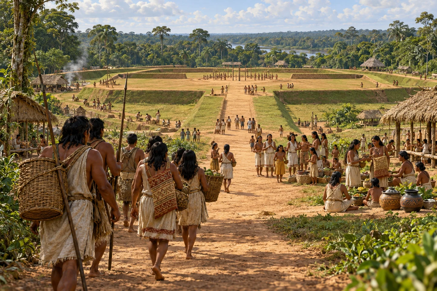
Upano · roads through a cultivated valley

Illustrative Upano Valley platforms, plazas, roads and cultivated spaces around AD 500.
AI-generated historical reconstruction. Illustrative Upano Valley platforms, plazas, roads and cultivated spaces around AD 500. The composition, people and buildings are imagined; this is not an exact site reconstruction or eyewitness record.

Our first close view takes us to the eastern foothills of the Andes, in the Upano Valley of present-day Ecuador. By about five hundred BC, people are establishing settlements here. Over the following centuries they build earthen house platforms, plazas and roads, alongside cultivated spaces and drainage works. Archaeologists call this garden urbanism. Houses, fields and connections between communities belong to the same landscape. The dated occupation extends into roughly AD three hundred to six hundred. These are not newly arrived people in an empty forest: their built environment rests on much older Amazonian traditions of cultivation and landscape knowledge.

Historical dates and route context

Dates locate broad historical periods unless a research publication is identified. Map labels show approximate cultural periods, including earlier and later occupations for comparison; they are retrospective context, not claims that all sites were occupied on this date. Modern borders are not ancient political boundaries.

Sources: Rostain et al., Science (2024): Two thousand years of garden urbanism

Aquiry · gathering places in the forest

Illustrative gathering beside an Aquiry earthen enclosure and avenue.
AI-generated historical reconstruction. Illustrative gathering beside an Aquiry earthen enclosure and avenue. The composition, people and buildings are imagined; this is not an exact site reconstruction or eyewitness record.

While settlements flourish in Upano, another monumental tradition extends across southwestern Amazonia. In present-day Acre and neighbouring areas, communities dig geometric enclosures and build avenues. Archaeologists call this cultural network Aquiry. Construction begins around six hundred BC; its apparent peak falls around AD one hundred to three hundred. Many enclosures seem to be places for periodic political and ceremonial gatherings, rather than permanent residential towns. People living around them cultivate crops and manage useful trees. The forest is part of their inhabited world. By about the ninth century, this monumental tradition ends for reasons still uncertain, long before European conquest.

Historical dates and route context

Dates locate broad historical periods unless a research publication is identified. Map labels show approximate cultural periods, including earlier and later occupations for comparison; they are retrospective context, not claims that all sites were occupied on this date. Modern borders are not ancient political boundaries.

Sources: University of Helsinki: Aquiry communities, chronology and environmental legacy · Watling et al., PNAS (2017): geoglyph builders and forest management

Different societies, different landscapes

Casarabe · living with the flood

Illustrative Casarabe settlement and managed seasonal waters around AD 1200.
AI-generated historical reconstruction. Illustrative Casarabe settlement and managed seasonal waters around AD 1200. The composition, people and buildings are imagined; this is not an exact site reconstruction or eyewitness record.

The story continues southeast, in the seasonal plains of present-day Bolivia. Between about AD five hundred and fourteen hundred, Casarabe communities build a different kind of inhabited landscape. At centres such as Cotoca, monumental platforms and mounds rise above the plains. Causeways and water infrastructure connect settlements across the surrounding country. Here, seasonal flooding shapes the work of growing food and moving between places. This is low-density urbanism, spread among centres and cultivated spaces. It does not replace the older societies everywhere else. Amazonia has many overlapping histories, adapting to different forests, rivers and savannas.

Historical dates and route context

Dates locate broad historical periods unless a research publication is identified. Map labels show approximate cultural periods, including earlier and later occupations for comparison; they are retrospective context, not claims that all sites were occupied on this date. Modern borders are not ancient political boundaries.

Sources: Prümers et al., Nature (2022): low-density urbanism in Casarabe culture · Lombardo et al., Nature (2025): water management and maize farming

Amazonia around 1500 and after

Upper Xingu · roads, plazas and living memory

Illustrative Upper Xingu plaza settlement and gardens around AD 1500.
AI-generated historical reconstruction. Illustrative Upper Xingu plaza settlement and gardens around AD 1500. The composition, people and buildings are imagined; this is not an exact site reconstruction or eyewitness record.

By around fifteen hundred, another network flourishes in the Upper Xingu of present-day Brazil. Broad roads connect settlements organized around plazas. Gardens and managed vegetation extend beyond the houses. These are small independent polities, rather than provinces of one Amazon-wide empire. Indigenous collaborators, including Kuikuro people, help researchers understand the old settlements and the landscapes around them. Knowledge of fertile dark earth also connects present-day practices with archaeological questions about earlier occupation. The threads now come together: roads in Upano, gathering places in Acre, water systems in Bolivia and connected communities in the Xingu reveal different ways of making an inhabited Amazon.

Historical dates and route context

Dates locate broad historical periods unless a research publication is identified. Map labels show approximate cultural periods, including earlier and later occupations for comparison; they are retrospective context, not claims that all sites were occupied on this date. Modern borders are not ancient political boundaries.

Sources: Heckenberger et al., Science (2008): Pre-Columbian urbanism in Amazonia · Schmidt et al., Science Advances (2023): intentional dark-earth formation and Kuikuro knowledge

Many places, different centuries

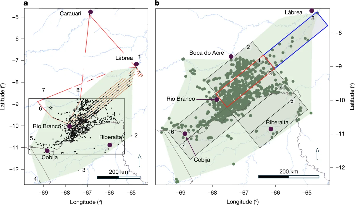
Research map showing Aquiry-associated earthworks and survey coverage in southwestern Amazonia.
The estimated archaeological distribution of Aquiry-associated earthworks; this is a cultural study area, not a political border. Pärssinen et al. (2026), Figure 3, CC BY 4.0. Resized without cropping.

Seen together, these places change the meaning of the forest. They show long histories of building, farming and managing landscapes, with different societies reaching their greatest extent at different times. Upano's early settlements, Aquiry's earthworks, Casarabe's centres and the Upper Xingu networks did not all flourish together in fifteen hundred. Nor do they establish one unified civilization. There was no basin-wide census, and population estimates depend on uneven evidence and assumptions about unstudied areas. The secure story does not need one dramatic total. It is the history of many peoples whose settlements and knowledge helped shape the Amazon we know today.

Historical dates and route context

Dates locate broad historical periods unless a research publication is identified. Map labels show approximate cultural periods, including earlier and later occupations for comparison; they are retrospective context, not claims that all sites were occupied on this date. Modern borders are not ancient political boundaries.

Sources: McMichael et al., PNAS (2017): population estimates and uneven human impacts · Clement et al. (2015): The domestication of Amazonia before European conquest · McMichael, Piperno and Bush (2015): spatial variation and extrapolation limits · Rostain et al., Science (2024): Two thousand years of garden urbanism · Prümers et al., Nature (2022): low-density urbanism in Casarabe culture · Heckenberger et al., Science (2008): Pre-Columbian urbanism in Amazonia · Image source and licence · CC BY 4.0 licence
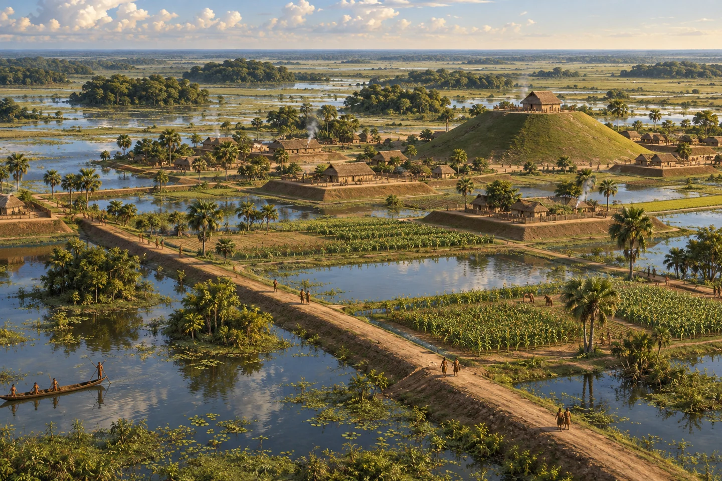
Conquest changes the inhabited landscape

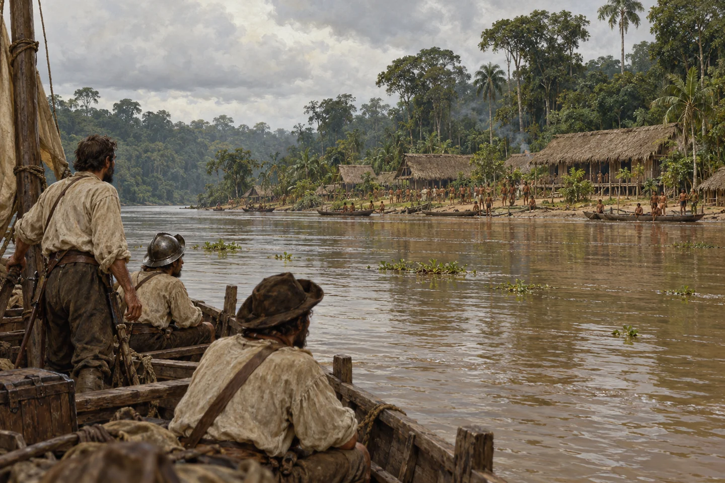
Illustrative inhabited Amazon riverbank during the era of Orellana’s 1542 expedition.
AI-generated historical reconstruction. Illustrative inhabited Amazon riverbank during the era of Orellana’s 1542 expedition. The composition, people and buildings are imagined; this is not an exact site reconstruction or eyewitness record.

That long history faces a profound rupture after Europeans arrive. In fifteen forty-two, Gaspar de Carvajal accompanies Francisco de Orellana down the river and describes inhabited banks and substantial communities. His account is a colonial witness's testimony, not a census, and must be compared with archaeology. Introduced diseases, enslavement, violence and displacement devastate Indigenous populations over the following centuries. Communities move, adapt and survive. Many places become overgrown. Later outsiders can mistake the aftermath of catastrophe for a forest that had always been sparsely inhabited. Indigenous histories and knowledge continue, even when buildings and fields become difficult to see.

Historical dates and route context

Dates locate broad historical periods unless a research publication is identified. Map labels show approximate cultural periods, including earlier and later occupations for comparison; they are retrospective context, not claims that all sites were occupied on this date. Modern borders are not ancient political boundaries. The mapped 1541–1542 Napo and Amazon descent reuses Histlas Explorations. River bends and intermediate dates are reconstructed; the line is a contextual route, not a claim of exact positions.

Sources: Smithsonian Libraries: Carvajal’s account of the Amazon expedition · Science Panel for the Amazon (2021): Amazonian peoples and colonial history · Orellana descent · historical route source

What archaeology is revealing now

2022 · recovering Casarabe’s connected landscape

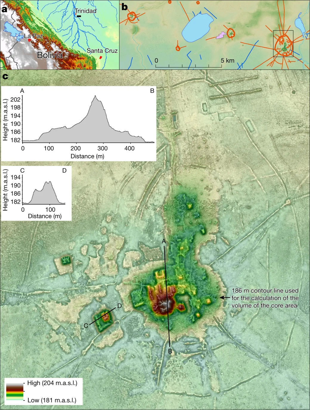
Three research panels showing the Cotoca settlement area, archaeological features and lidar terrain model.
Lidar mapping of Cotoca and its surroundings reveals monumental platforms, causeways and other archaeological features. Prümers et al. (2022), Figure 2, CC BY 4.0. Resized without cropping.

Modern research begins to reconnect those obscured histories. Excavation, dating and Indigenous knowledge already challenge the picture of an almost empty Amazon. Airborne laser scanning, called lidar, adds a way to map the ground through gaps in the canopy. In twenty twenty-two, a Casarabe study brings centres, platforms and connections into a clearer regional picture. The discoveries matter together: a mound is no longer an isolated curiosity when its causeways and surrounding settlements become visible. Lidar reveals shapes; it cannot supply ancient names, languages or a population count on its own. Archaeology still has to establish when places were occupied and how they worked.

Historical dates and route context

Dates locate broad historical periods unless a research publication is identified. Map labels show approximate cultural periods, including earlier and later occupations for comparison; they are retrospective context, not claims that all sites were occupied on this date. Modern borders are not ancient political boundaries.

Sources: Prümers et al., Nature (2022): low-density urbanism in Casarabe culture · Image source and licence · CC BY 4.0 licence

2024–2025 · joining settlements to everyday life

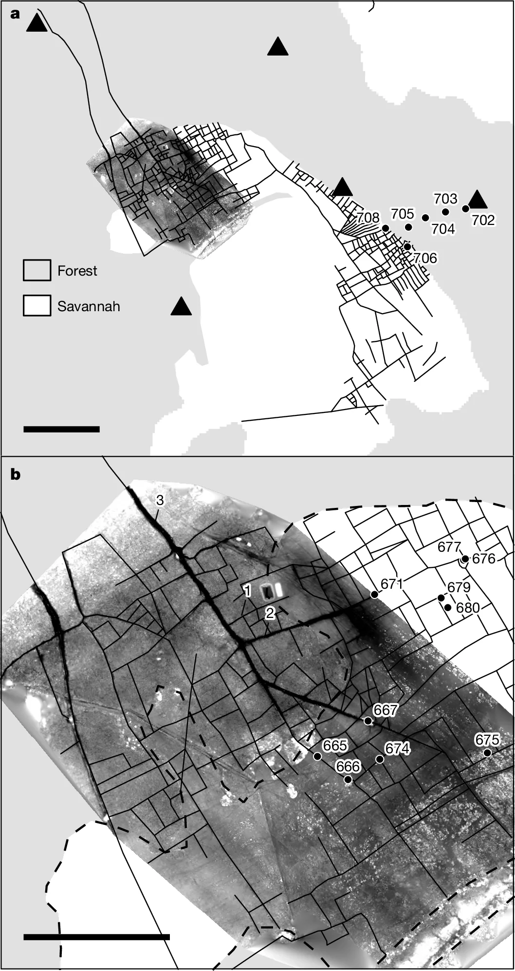
Research maps showing drainage canals and the forest–savannah boundary in a Casarabe agricultural landscape.
A drainage network and digital elevation model document Casarabe landscape engineering in the Bolivian Amazon. Lombardo et al. (2025), Figure 2, CC BY 4.0. Resized without cropping.

The next findings strengthen the connections between buildings and the people who sustained them. Published in twenty twenty-four, the Upano research combines fieldwork and lidar to reveal an extensive system of platforms, roads and cultivated spaces. In twenty twenty-five, a Casarabe study examines drainage canals and farm ponds. Canals remove excess water during the rains; ponds retain it through the dry season. Plant remains point to maize cultivation. The two studies concern different regions and centuries, but answer a shared question: how could these landscapes support substantial communities? Their evidence directs attention beyond monuments, towards food, seasonal water and accumulated local knowledge.

Historical dates and route context

Dates locate broad historical periods unless a research publication is identified. Map labels show approximate cultural periods, including earlier and later occupations for comparison; they are retrospective context, not claims that all sites were occupied on this date. Modern borders are not ancient political boundaries.

Sources: Rostain et al., Science (2024): Two thousand years of garden urbanism · Lombardo et al., Nature (2025): water management and maize farming · Image source and licence · CC BY 4.0 licence

2026 · separate findings become a larger history

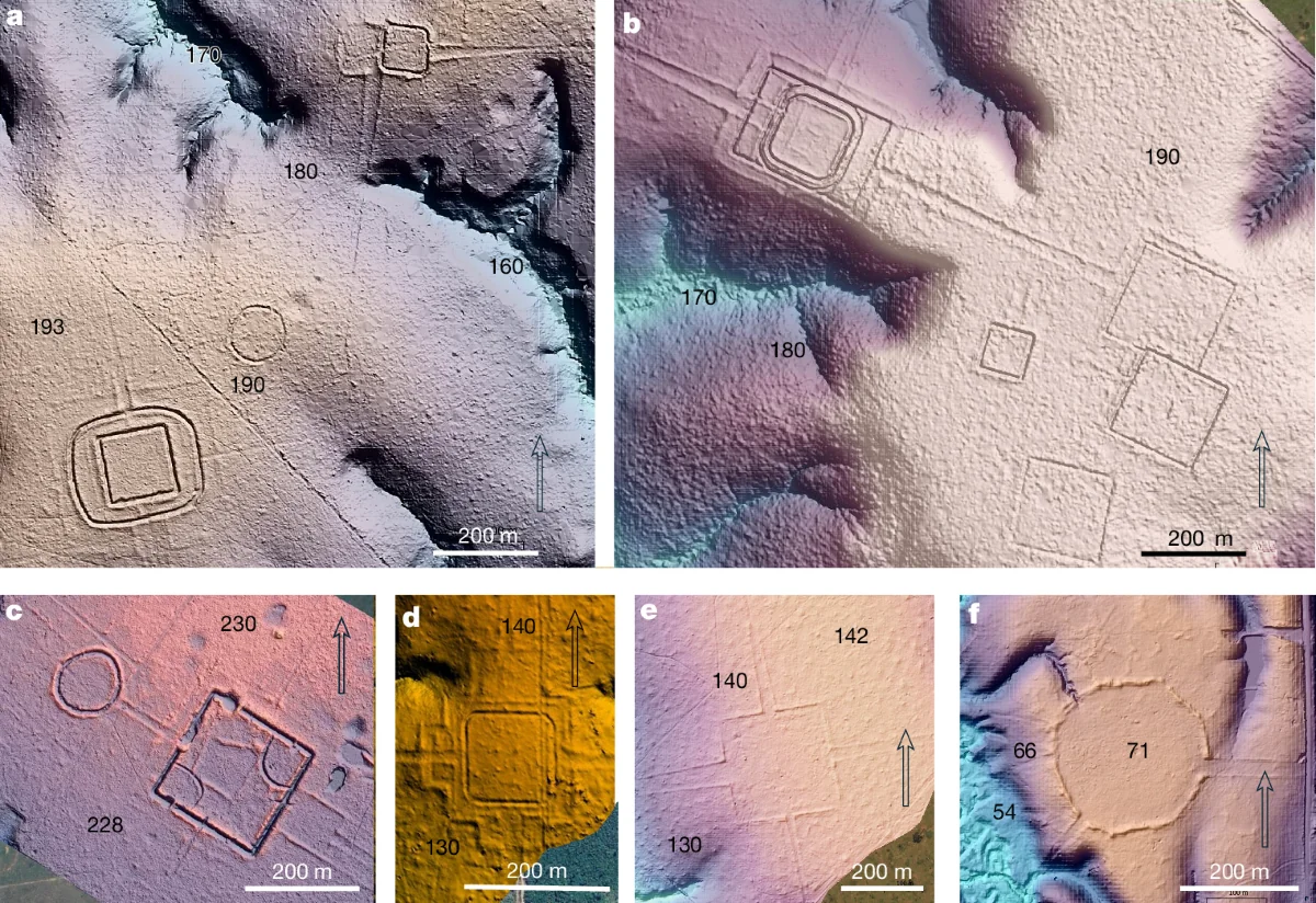
Six coloured terrain models showing different geometric earthworks and their topographical contexts.
Lidar-derived terrain models reveal varied geometric earthworks, including Piloto, D. Schaan and Fazenda Atlântica. Pärssinen et al. (2026), Figure 2, CC BY 4.0. Resized without cropping.

In July twenty twenty-six, the Aquiry study adds hundreds of newly recorded earthworks to this growing picture. Its regional population model concerns AD one hundred to three hundred, not the whole Amazon in fifteen hundred. Read alongside Upano, Casarabe and the Upper Xingu, the finding reveals how much remains to be learned between the best-studied places. These societies were separated by distance, by time and by different ways of organizing life. What connects them is a long history of people shaping forests, soils and waterways. Amazonia's past is neither an empty wilderness nor a single vanished empire. It is many human histories, with living Indigenous peoples carrying them forward.

Historical dates and route context

Dates locate broad historical periods unless a research publication is identified. Map labels show approximate cultural periods, including earlier and later occupations for comparison; they are retrospective context, not claims that all sites were occupied on this date. Modern borders are not ancient political boundaries.

Sources: Pärssinen et al., Nature (29 July 2026): Aquiry earthworks and population model · University of Helsinki: Aquiry communities, chronology and environmental legacy · Schmidt et al., Science Advances (2023): intentional dark-earth formation and Kuikuro knowledge · Rostain et al., Science (2024): Two thousand years of garden urbanism · Prümers et al., Nature (2022): low-density urbanism in Casarabe culture · Heckenberger et al., Science (2008): Pre-Columbian urbanism in Amazonia · Image source and licence · CC BY 4.0 licence