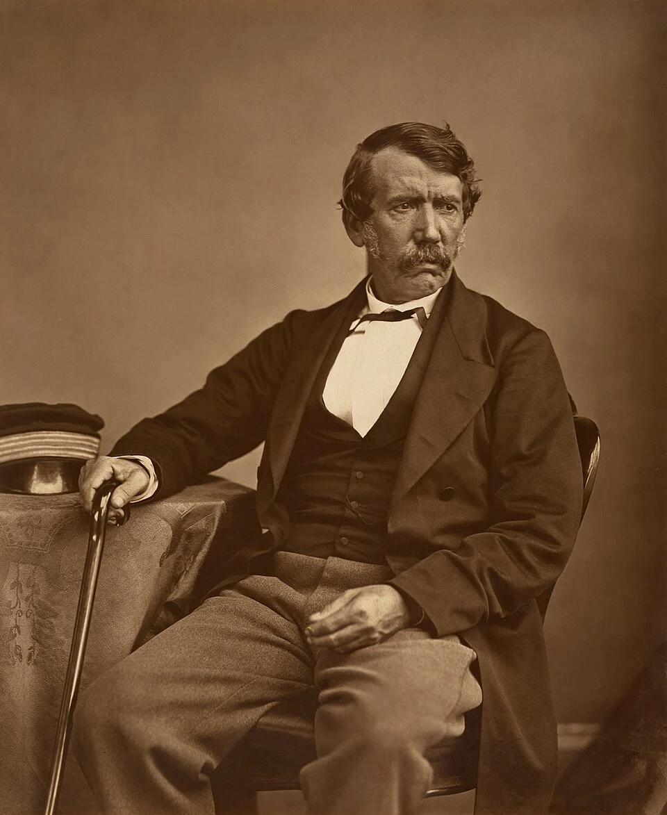
David Livingstone photographed by Thomas Annan in the nineteenth century; a later portrait than the introductory 1841 setting. Thomas Annan / Adam Cuerden · Public domain.
David Livingstone was a Scottish doctor, missionary and explorer who travelled through southern and central Africa in the nineteenth century. He hoped that Christianity and new trading routes would help defeat the slave trade. His journeys brought him fame, but they depended on African knowledge, labour and political support. Beginning with his arrival in southern Africa in 1841, we will follow his changing ambitions, costly mistakes and the companions who made his travels possible.
Historical dates and route context
Routes, waypoint dates, expedition modes and moving positions come directly from the four Livingstone journeys in Explorations. Dashed lines show their selected schematic routes and solid lines the dated progress. Approximate intermediate dates are animation anchors, not exact arrival claims. The 1849 Lake Ngami journey, crossing, Zambezi expedition and final journey are separate expeditions; overseas transfers, many intermediate movements and the companions’ return after his death are not mapped. The coarse expedition marker is not Livingstone’s exact position on every narrated day. Modern borders do not reconstruct nineteenth-century political geography.
Historical portrait of Mary Moffat Livingstone; not a portrait made at this particular Kolobeng scene. Unknown authorUnknown author · Public domain.
By 1849, Kolobeng is Livingstone’s base among Sechele’s Bakwena. Mary brings language skills and experience to their mission. On the first of June, Livingstone leaves for Lake Ngami with William Cotton Oswell, Mungo Murray and African guides. Wagons carry supplies across sandy country, where water decides the pace. At Serotli, their guide Ramotobi knows water lies beneath apparently dry sand. Digging opens wells, but the oxen must be sent back to another water source. Reaching the lake will take two months.
Historical dates and route context
Routes, waypoint dates, expedition modes and moving positions come directly from the four Livingstone journeys in Explorations. Dashed lines show their selected schematic routes and solid lines the dated progress. Approximate intermediate dates are animation anchors, not exact arrival claims. The 1849 Lake Ngami journey, crossing, Zambezi expedition and final journey are separate expeditions; overseas transfers, many intermediate movements and the companions’ return after his death are not mapped. The coarse expedition marker is not Livingstone’s exact position on every narrated day. Modern borders do not reconstruct nineteenth-century political geography. The 1849 outward journey is a separate Exploration record. Its line between Kolobeng and Lake Ngami is schematic; intermediate wells and river detours are not reconstructed. The return to Kolobeng is described but not mapped.
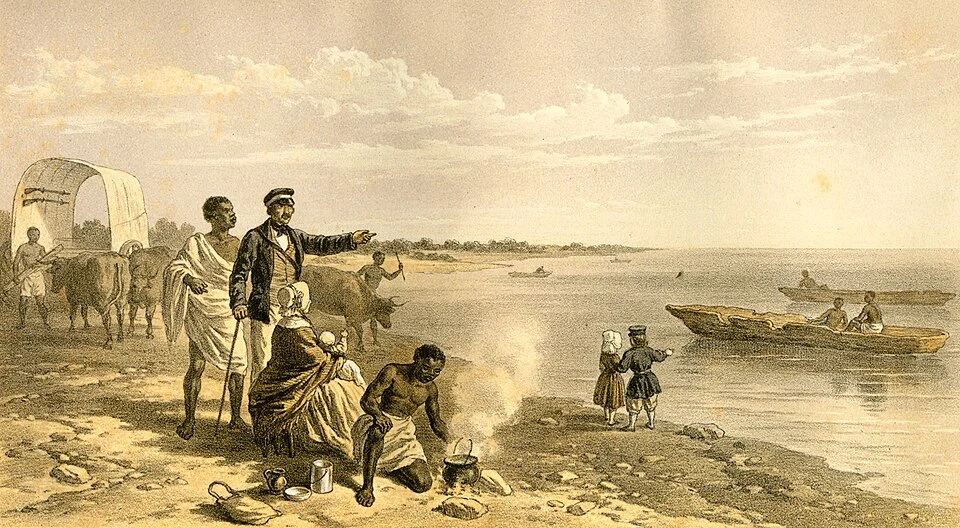
Lake Ngami in a nineteenth-century expedition illustration. Its historic title uses the language of European discovery; the lake was already known locally. David Livingstone · Public domain.
On the first of August, the travellers reach the broad waters of Lake Ngami. Their crossing has depended on African guides and knowledge of water sources. Livingstone hopes to continue north to the ruler Sebituane, but cannot obtain the guides he needs. This expedition ends with a return to Kolobeng, rather than a passage across Africa. Further northern journeys follow in 1850 and 1851, before the separate coast-to-coast expedition begins in 1852.
Historical dates and route context
Routes, waypoint dates, expedition modes and moving positions come directly from the four Livingstone journeys in Explorations. Dashed lines show their selected schematic routes and solid lines the dated progress. Approximate intermediate dates are animation anchors, not exact arrival claims. The 1849 Lake Ngami journey, crossing, Zambezi expedition and final journey are separate expeditions; overseas transfers, many intermediate movements and the companions’ return after his death are not mapped. The coarse expedition marker is not Livingstone’s exact position on every narrated day. Modern borders do not reconstruct nineteenth-century political geography. The 1849 outward journey is a separate Exploration record. Its line between Kolobeng and Lake Ngami is schematic; intermediate wells and river detours are not reconstructed. The return to Kolobeng is described but not mapped.
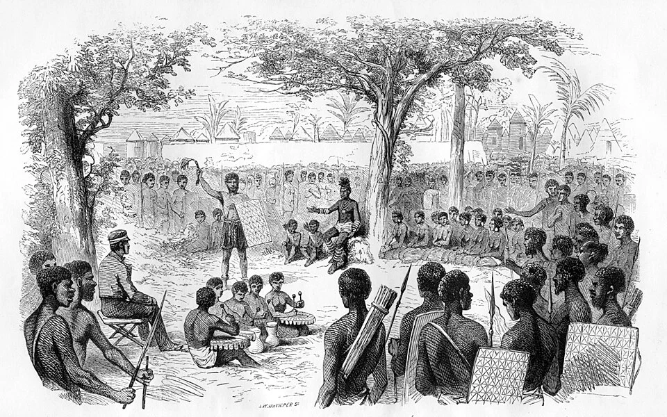
Reception of Livingstone’s party by Shinte, illustrated in the nineteenth century. This depicts an encounter on the western journey, not Sekeletu at Linyanti. David Livingstone · Public domain.
Leaving Cape Town, Livingstone travels north towards Linyanti, where Sekeletu supports an attempt to reach the Atlantic port of Luanda. The Kololo ruler provides goods and companions for the journey west. Along the way, the party negotiates with rulers and communities, exchanging information and obtaining supplies. Luanda is their distant objective, but African routes, knowledge and political support make progress possible.
Historical dates and route context
Routes, waypoint dates, expedition modes and moving positions come directly from the four Livingstone journeys in Explorations. Dashed lines show their selected schematic routes and solid lines the dated progress. Approximate intermediate dates are animation anchors, not exact arrival claims. The 1849 Lake Ngami journey, crossing, Zambezi expedition and final journey are separate expeditions; overseas transfers, many intermediate movements and the companions’ return after his death are not mapped. The coarse expedition marker is not Livingstone’s exact position on every narrated day. Modern borders do not reconstruct nineteenth-century political geography.
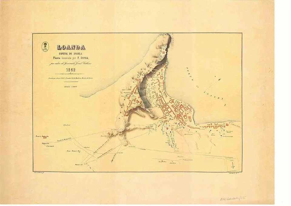
A plan of Luanda from 1862, several years after Livingstone’s arrival. Later urban context, not an exact map of the port in 1854. Sá da Bandeira, Marquês de, 1795-1876 · Public domain.
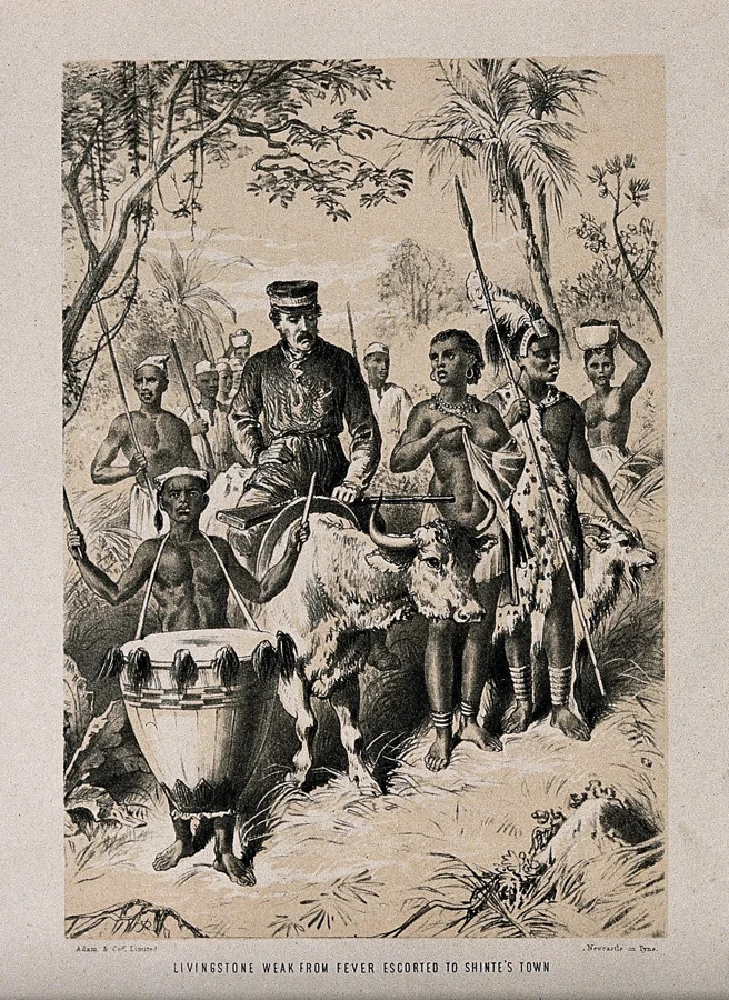
At Luanda in May 1854, Livingstone is ill and exhausted after months of travel. He could leave Africa by sea, but decides instead to return inland and seek a more practical route to the east coast. The party heads back towards Linyanti. The western journey has not delivered an easy commercial highway, and his companions also have homes and people to return to. Illness makes the return arduous; at times Livingstone rides an ox rather than walking. Each day’s progress depends on the strength and support of the travelling party.
Historical dates and route context
Routes, waypoint dates, expedition modes and moving positions come directly from the four Livingstone journeys in Explorations. Dashed lines show their selected schematic routes and solid lines the dated progress. Approximate intermediate dates are animation anchors, not exact arrival claims. The 1849 Lake Ngami journey, crossing, Zambezi expedition and final journey are separate expeditions; overseas transfers, many intermediate movements and the companions’ return after his death are not mapped. The coarse expedition marker is not Livingstone’s exact position on every narrated day. Modern borders do not reconstruct nineteenth-century political geography.
Nineteenth-century illustration of Livingstone travelling on an ox while ill during the western journey. Context for the difficulties of travel, not a view of this particular eastward approach. · CC BY 4.0.
After returning to Linyanti, Livingstone again receives Sekeletu’s support for a journey east. The months of walking have shown how much depends on local alliances, food supplies and the health of the travellers. Ahead lies the great waterfall on the Zambezi, known as Mosi-oa-Tunya. His guides will bring him to a place already named, known and understood by people living in the region.
Historical dates and route context
Routes, waypoint dates, expedition modes and moving positions come directly from the four Livingstone journeys in Explorations. Dashed lines show their selected schematic routes and solid lines the dated progress. Approximate intermediate dates are animation anchors, not exact arrival claims. The 1849 Lake Ngami journey, crossing, Zambezi expedition and final journey are separate expeditions; overseas transfers, many intermediate movements and the companions’ return after his death are not mapped. The coarse expedition marker is not Livingstone’s exact position on every narrated day. Modern borders do not reconstruct nineteenth-century political geography.
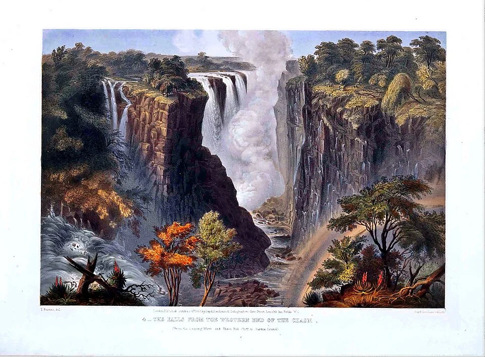
Thomas Baines’s Victoria Falls lithograph, published in 1865 after his own visit; not an eyewitness picture of Livingstone’s 1855 arrival. Thomas Baines · Public domain.
Spray rises above the gorge as the Zambezi plunges over Mosi-oa-Tunya. Livingstone names it Victoria Falls in honour of Britain’s queen. His account will make the waterfall famous among European readers, but he has not discovered a place unknown to humanity. African guides have led him here. The immense drop also hints at a practical problem: a river can connect communities without offering an uninterrupted route for steam navigation. From here, the journey continues east towards the Indian Ocean and Quelimane.
Historical dates and route context
Routes, waypoint dates, expedition modes and moving positions come directly from the four Livingstone journeys in Explorations. Dashed lines show their selected schematic routes and solid lines the dated progress. Approximate intermediate dates are animation anchors, not exact arrival claims. The 1849 Lake Ngami journey, crossing, Zambezi expedition and final journey are separate expeditions; overseas transfers, many intermediate movements and the companions’ return after his death are not mapped. The coarse expedition marker is not Livingstone’s exact position on every narrated day. Modern borders do not reconstruct nineteenth-century political geography.
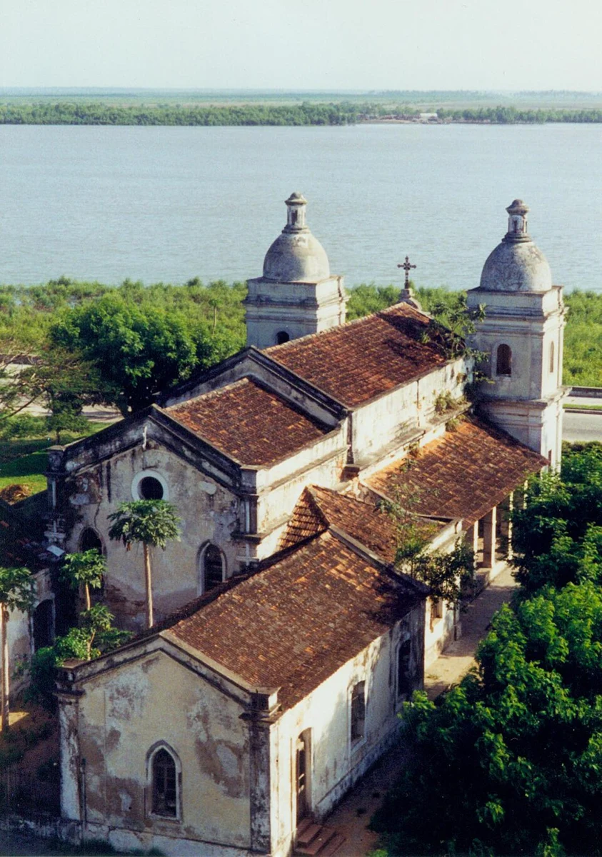
Quelimane’s old cathedral photographed in 1997; later town context, not the cityscape encountered in 1856. Claus Bunks aka Afrobrasil on flickr · Public domain.
By May 1856, Livingstone reaches Quelimane on the Indian Ocean coast, after passing through Tete. He has linked the Atlantic and Indian Ocean sides of southern Africa in a journey that will make him a celebrity in Britain. Yet African and Arab traders have long travelled extensive routes across the continent. His achievement rests on those connections, and it does not establish that the Zambezi is a navigable highway all the way inland.
Historical dates and route context
Routes, waypoint dates, expedition modes and moving positions come directly from the four Livingstone journeys in Explorations. Dashed lines show their selected schematic routes and solid lines the dated progress. Approximate intermediate dates are animation anchors, not exact arrival claims. The 1849 Lake Ngami journey, crossing, Zambezi expedition and final journey are separate expeditions; overseas transfers, many intermediate movements and the companions’ return after his death are not mapped. The coarse expedition marker is not Livingstone’s exact position on every narrated day. Modern borders do not reconstruct nineteenth-century political geography.
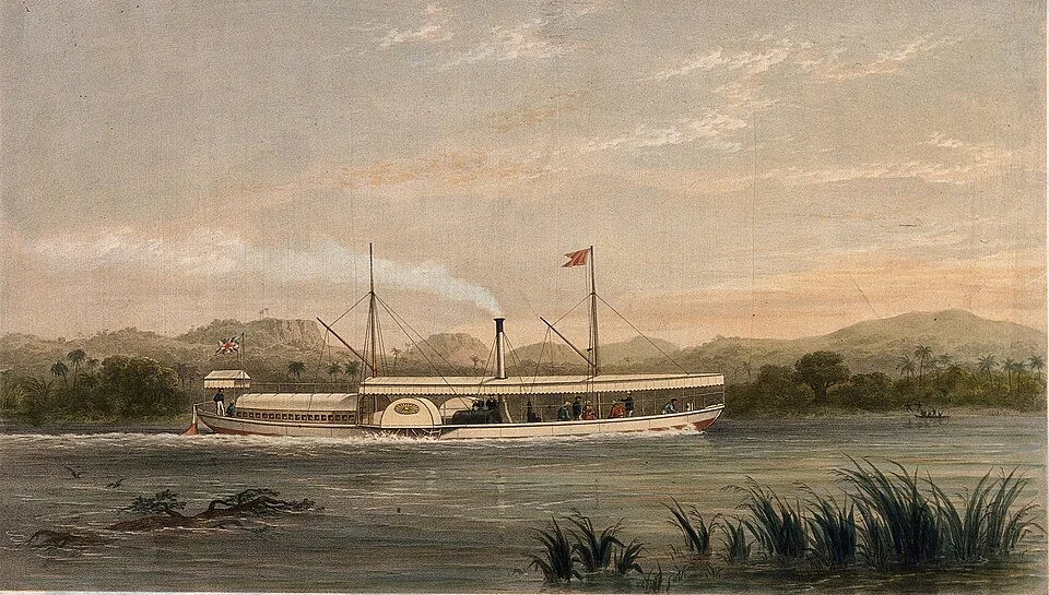
Ma Robert, the expedition’s steamer, in an 1858 illustration. The vessel image provides context for an expedition that used several craft over time. TA Picken after S. Walters · Public domain.
In 1858, Livingstone returns with British support, scientists and a small steamer. Ma Robert arrives from England in three sections, which are bolted together at the anchorage. Even finding an entrance is difficult: one promising channel ends in marshes. Heading upstream towards Tete, the expedition faces the Kebrabasa rapids, which block the hoped-for river highway. Work turns towards the Shire and Lake Malawi. Equipment failures and illness complicate the journey, while scientific collecting continues.
Historical dates and route context
Routes, waypoint dates, expedition modes and moving positions come directly from the four Livingstone journeys in Explorations. Dashed lines show their selected schematic routes and solid lines the dated progress. Approximate intermediate dates are animation anchors, not exact arrival claims. The 1849 Lake Ngami journey, crossing, Zambezi expedition and final journey are separate expeditions; overseas transfers, many intermediate movements and the companions’ return after his death are not mapped. The coarse expedition marker is not Livingstone’s exact position on every narrated day. Modern borders do not reconstruct nineteenth-century political geography.
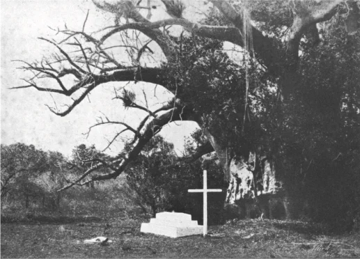
Mary Livingstone’s grave photographed by John Kirk in 1862; historical evidence of the personal losses of the Zambezi expedition. John Kirk (1832-1922) · Public domain.
Mary rejoins the expedition in 1862, but soon dies at Shupanga on the Zambezi. Her death ends years of difficult journeys and long family separations. She has been a teacher, a negotiator and an essential partner, not merely a figure waiting at home. The expedition continues under deepening criticism before its recall. Scientific collections survive, but they must be understood alongside failed plans and lives lost. The expedition will return to Britain in 1864, before another inland journey begins in 1866.
Historical dates and route context
Routes, waypoint dates, expedition modes and moving positions come directly from the four Livingstone journeys in Explorations. Dashed lines show their selected schematic routes and solid lines the dated progress. Approximate intermediate dates are animation anchors, not exact arrival claims. The 1849 Lake Ngami journey, crossing, Zambezi expedition and final journey are separate expeditions; overseas transfers, many intermediate movements and the companions’ return after his death are not mapped. The coarse expedition marker is not Livingstone’s exact position on every narrated day. Modern borders do not reconstruct nineteenth-century political geography.
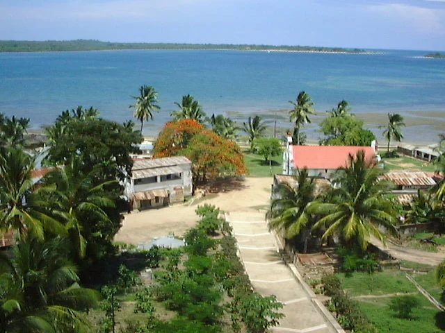
Mikindani Bay in a modern photograph; geographical context, not a reconstruction of the 1866 departure. Ajoh198 · CC BY-SA 3.0.
From Mikindani in 1866, Livingstone sets out towards the lakes of central Africa. Travel soon becomes a struggle for food. His diary describes heavy rain and meals of millet porridge; hunger drives a guide to leave. After crossing the Chambezi in January 1867, the party finds better supplies. Progress still requires negotiation: demands for cloth and blankets, and Livingstone’s illness, keep him in one village for weeks. The journey continues through the regions of Lakes Mweru and Bangweulu, seeking rivers he hopes will lead to the Nile.
Historical dates and route context
Routes, waypoint dates, expedition modes and moving positions come directly from the four Livingstone journeys in Explorations. Dashed lines show their selected schematic routes and solid lines the dated progress. Approximate intermediate dates are animation anchors, not exact arrival claims. The 1849 Lake Ngami journey, crossing, Zambezi expedition and final journey are separate expeditions; overseas transfers, many intermediate movements and the companions’ return after his death are not mapped. The coarse expedition marker is not Livingstone’s exact position on every narrated day. Modern borders do not reconstruct nineteenth-century political geography.
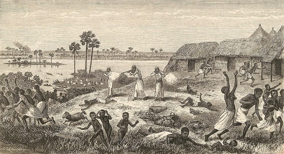
Nineteenth-century illustration of the Nyangwe massacre, published with Livingstone’s journals; a mediated representation, not an eyewitness photograph. David Livingstone · Public domain.
At Nyangwe, on the Lualaba River, Livingstone witnesses a massacre at a busy market in July 1871. Gunmen associated with slave-trading interests attack a population including many women. People flee towards the river, where many drown. His accounts describe the horror, although their details and casualty estimates differ. The experience strengthens his public denunciations of the slave trade. Yet illness and shortages have also made him dependent on traders within that same commercial world.
Historical dates and route context
Routes, waypoint dates, expedition modes and moving positions come directly from the four Livingstone journeys in Explorations. Dashed lines show their selected schematic routes and solid lines the dated progress. Approximate intermediate dates are animation anchors, not exact arrival claims. The 1849 Lake Ngami journey, crossing, Zambezi expedition and final journey are separate expeditions; overseas transfers, many intermediate movements and the companions’ return after his death are not mapped. The coarse expedition marker is not Livingstone’s exact position on every narrated day. Modern borders do not reconstruct nineteenth-century political geography.
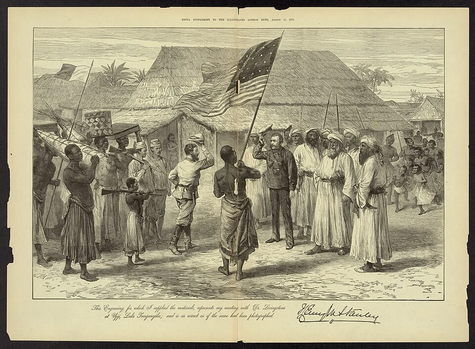
Later illustration of Stanley meeting Livingstone; part of the public imagery that shaped the encounter’s fame. Miscellaneous Items in High Demand, PPOC, Library of Congress · Public domain.
At Ujiji, beside Lake Tanganyika, the journalist Henry Morton Stanley finds Livingstone in 1871. Stanley brings supplies and news, and turns their meeting into an international sensation. The famous greeting, Doctor Livingstone, I presume, belongs to that carefully shaped public story. Livingstone welcomes the assistance but declines to abandon his work. He still hopes to resolve the river system, although the Lualaba belongs to the Congo drainage rather than the Nile.
Historical dates and route context
Routes, waypoint dates, expedition modes and moving positions come directly from the four Livingstone journeys in Explorations. Dashed lines show their selected schematic routes and solid lines the dated progress. Approximate intermediate dates are animation anchors, not exact arrival claims. The 1849 Lake Ngami journey, crossing, Zambezi expedition and final journey are separate expeditions; overseas transfers, many intermediate movements and the companions’ return after his death are not mapped. The coarse expedition marker is not Livingstone’s exact position on every narrated day. Modern borders do not reconstruct nineteenth-century political geography. The scene follows the conventional 10 November dating; contemporary date reconstruction is disputed. The famous greeting is reported rather than treated as a verbatim transcript.
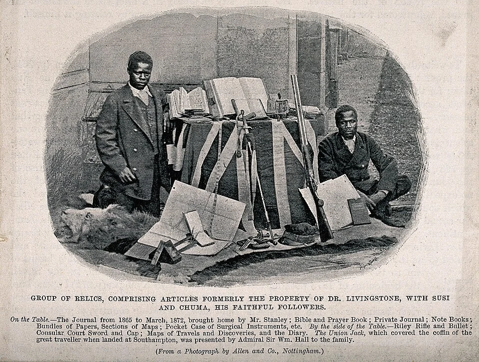
Susi and Chuma pictured with Livingstone’s former possessions in the nineteenth century. Historical catalogue descriptions use language of service that does not fully describe their expertise. · CC BY 4.0.
Livingstone becomes too weak to travel without help and dies near Chitambo, in present-day Zambia, in 1873. The companions who remain must now decide what happens next. Abdullah Susi, James Chuma and others preserve his papers and prepare his remains for a long journey to the coast. Their organisation, endurance and geographical knowledge demonstrate that these were accomplished travellers in their own right.
Historical dates and route context
Routes, waypoint dates, expedition modes and moving positions come directly from the four Livingstone journeys in Explorations. Dashed lines show their selected schematic routes and solid lines the dated progress. Approximate intermediate dates are animation anchors, not exact arrival claims. The 1849 Lake Ngami journey, crossing, Zambezi expedition and final journey are separate expeditions; overseas transfers, many intermediate movements and the companions’ return after his death are not mapped. The coarse expedition marker is not Livingstone’s exact position on every narrated day. Modern borders do not reconstruct nineteenth-century political geography. The conventional date is 1 May 1873; some scholarly accounts place death at the end of April. Exact death-site coordinates are approximate.
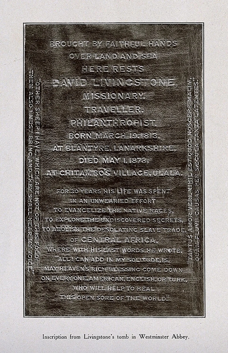
Photograph of Livingstone’s grave inscription at Westminster Abbey; memorial context rather than an image of the funeral itself. · CC BY 4.0.
Livingstone’s companions bring his remains to Bagamoyo before they are shipped to Britain. He is buried in London’s Westminster Abbey in April 1874. His story becomes a powerful symbol used by missionaries and advocates of empire. Today, his observations and opposition to slavery remain important, but so do his mistakes and the ambitions attached to his fame. Remembering the guides, communities and family behind the journeys gives us a fuller account of exploration.
Historical dates and route context
Routes, waypoint dates, expedition modes and moving positions come directly from the four Livingstone journeys in Explorations. Dashed lines show their selected schematic routes and solid lines the dated progress. Approximate intermediate dates are animation anchors, not exact arrival claims. The 1849 Lake Ngami journey, crossing, Zambezi expedition and final journey are separate expeditions; overseas transfers, many intermediate movements and the companions’ return after his death are not mapped. The coarse expedition marker is not Livingstone’s exact position on every narrated day. Modern borders do not reconstruct nineteenth-century political geography.


_-_H.H_LCCN2008678860.jpg)

