HISTORICAL STORY

The Maya · Cities and Living Histories

Early centres, rival kingdoms and continuing Maya worlds · c. 100 CE–today

▶ Play on the map

Deep roots and everyday life

The Maya · cities, landscapes and living peoples
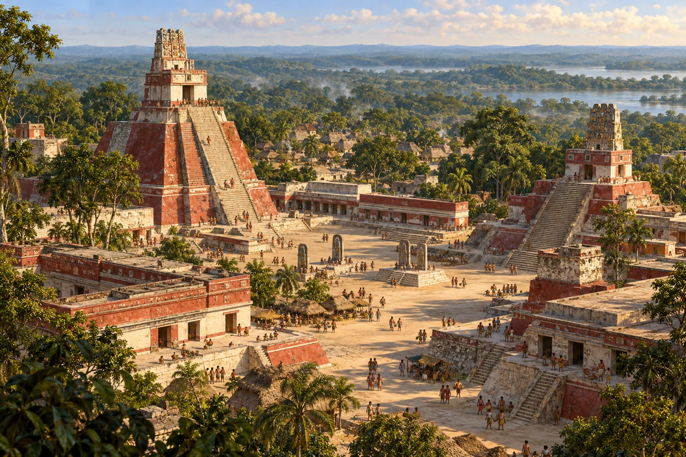
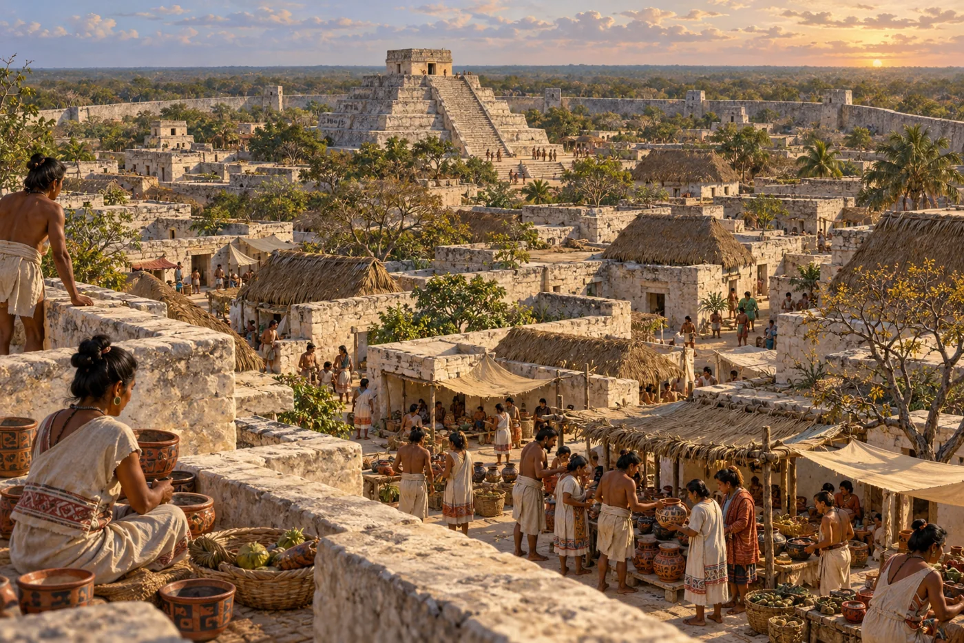
A representative Classic Maya temple plaza and inhabited lowland landscape around AD 700.
AI-generated historical reconstruction. Representative Classic Maya temple plaza around AD 700. People, buildings and details are imagined; this is not a verified site plan, portrait or eyewitness record.

The Maya are the peoples behind some of the great cities, carved histories and calendars of ancient Mesoamerica. Their homelands stretch across southern Mexico and northern Central America. Over many centuries, different Maya kingdoms rose, competed and changed; they were never one lasting empire. We will connect their cities with the work of farmers, artists and traders, then follow that history through conquest to the Maya communities who live today.

Historical dates and route context

A connected thematic history, not a single expedition or a map of one unified Maya empire. The opening date is an editorial anchor within the Late Preclassic; earlier history is described retrospectively. Most scene dates identify approximate periods, not exact construction, founding or abandonment days. Modern countries orient the viewer. Archaeological points represent public sites or broad urban contexts, not surveyed boundaries or sovereign territory. No region-wide population total is asserted. AI illustrations are labelled reconstructions or modern illustrations; imagined people, buildings and glyph details are not verified portraits, plans or readable historical records. Maya peoples and languages continue today.

Sources: Smithsonian NMAI · the Maya people · Smithsonian NMAI · living Maya perspectives
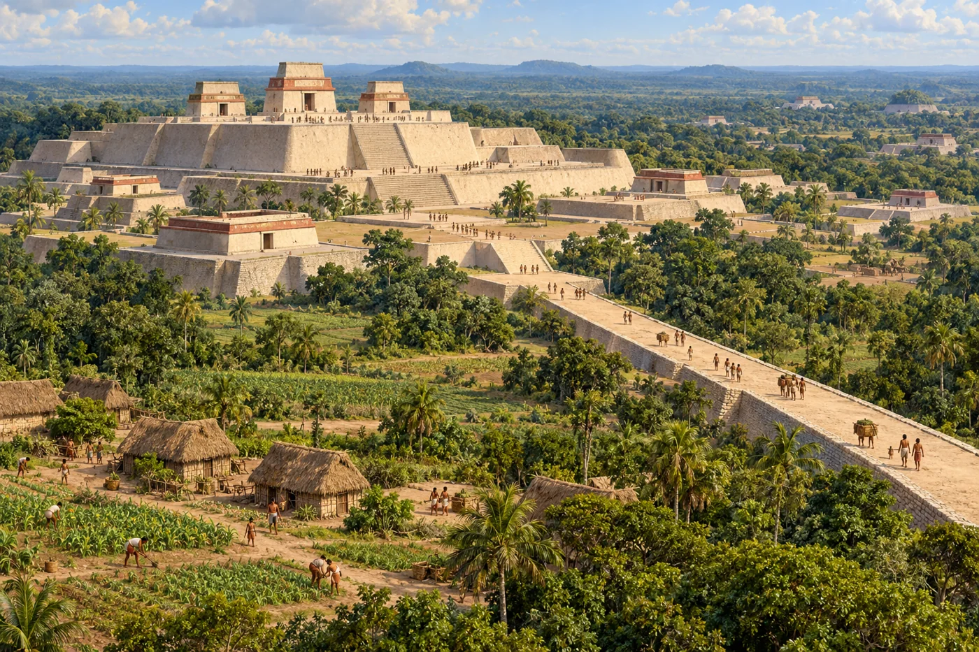
El Mirador · cities before the Classic kings

An imagined Late Preclassic El Mirador with broad triadic temple platforms, causeway and farmland around AD 100.
AI-generated historical reconstruction. Illustrative El Mirador and its cultivated landscape around AD 100. Architecture and people are imagined; this is not a verified site plan or eyewitness record.

Long before the best-known royal monuments, Maya communities were already building on a remarkable scale. At the El Mirador archaeological complex, immense platforms and temple groups belong to a history reaching back before the Common Era. Causeways connected places, while systems for collecting and managing water helped make settlement possible in a seasonally demanding landscape. Such construction depended on many kinds of work: growing food, quarrying stone, making lime plaster and moving materials. Archaeology reveals an early urban world built through generations of accumulated skill and shared effort.

Historical dates and route context

A connected thematic history, not a single expedition or a map of one unified Maya empire. The opening date is an editorial anchor within the Late Preclassic; earlier history is described retrospectively. Most scene dates identify approximate periods, not exact construction, founding or abandonment days. Modern countries orient the viewer. Archaeological points represent public sites or broad urban contexts, not surveyed boundaries or sovereign territory. No region-wide population total is asserted. AI illustrations are labelled reconstructions or modern illustrations; imagined people, buildings and glyph details are not verified portraits, plans or readable historical records. Maya peoples and languages continue today.

Sources: Idaho State University · El Mirador water systems and Late Preclassic archaeology · Hansen and colleagues · Mirador-Calakmul basin archaeological and LiDAR research

Joya de Cerén · the people behind the monuments

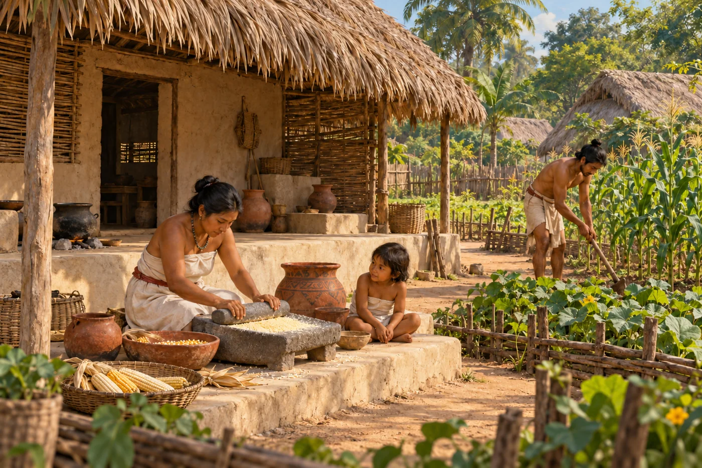
An imagined Maya farming household at Joya de Cerén around AD 600, before volcanic burial.
AI-generated historical reconstruction. Everyday household work at Joya de Cerén around AD 600, before volcanic burial. People, clothing and domestic details are imagined, not a verified household portrait or eyewitness record.

To understand this world, we also need to leave the palaces. At Joya de Ceren, volcanic ash preserved a farming community during the seventh century. Buildings, vessels and cultivation traces reveal ordinary routines rarely described in royal inscriptions. People grew maize, beans and squash, but their food was more varied than three crops. Archaeologists have identified manioc, chilli peppers and other plants in fields and kitchen gardens. Households tended these mixed plantings, stored harvests and ground maize on stone grinding tools. Preparing meals required knowledge and repeated labour, as well as a successful harvest. Maize was both nourishment and part of a wider understanding of the world. Such households sustained the wider Maya world.

Historical dates and route context

A connected thematic history, not a single expedition or a map of one unified Maya empire. The opening date is an editorial anchor within the Late Preclassic; earlier history is described retrospectively. Most scene dates identify approximate periods, not exact construction, founding or abandonment days. Modern countries orient the viewer. Archaeological points represent public sites or broad urban contexts, not surveyed boundaries or sovereign territory. No region-wide population total is asserted. AI illustrations are labelled reconstructions or modern illustrations; imagined people, buildings and glyph details are not verified portraits, plans or readable historical records. Maya peoples and languages continue today.

Sources: UNESCO · Joya de Cerén farming community · Smithsonian NMAI · corn and Maya time · Slotten, Lentz and Sheets (2020) · crops and kitchen gardens at Joya de Cerén

Courts, writing and time

Tikal and Calakmul · a world of rival courts

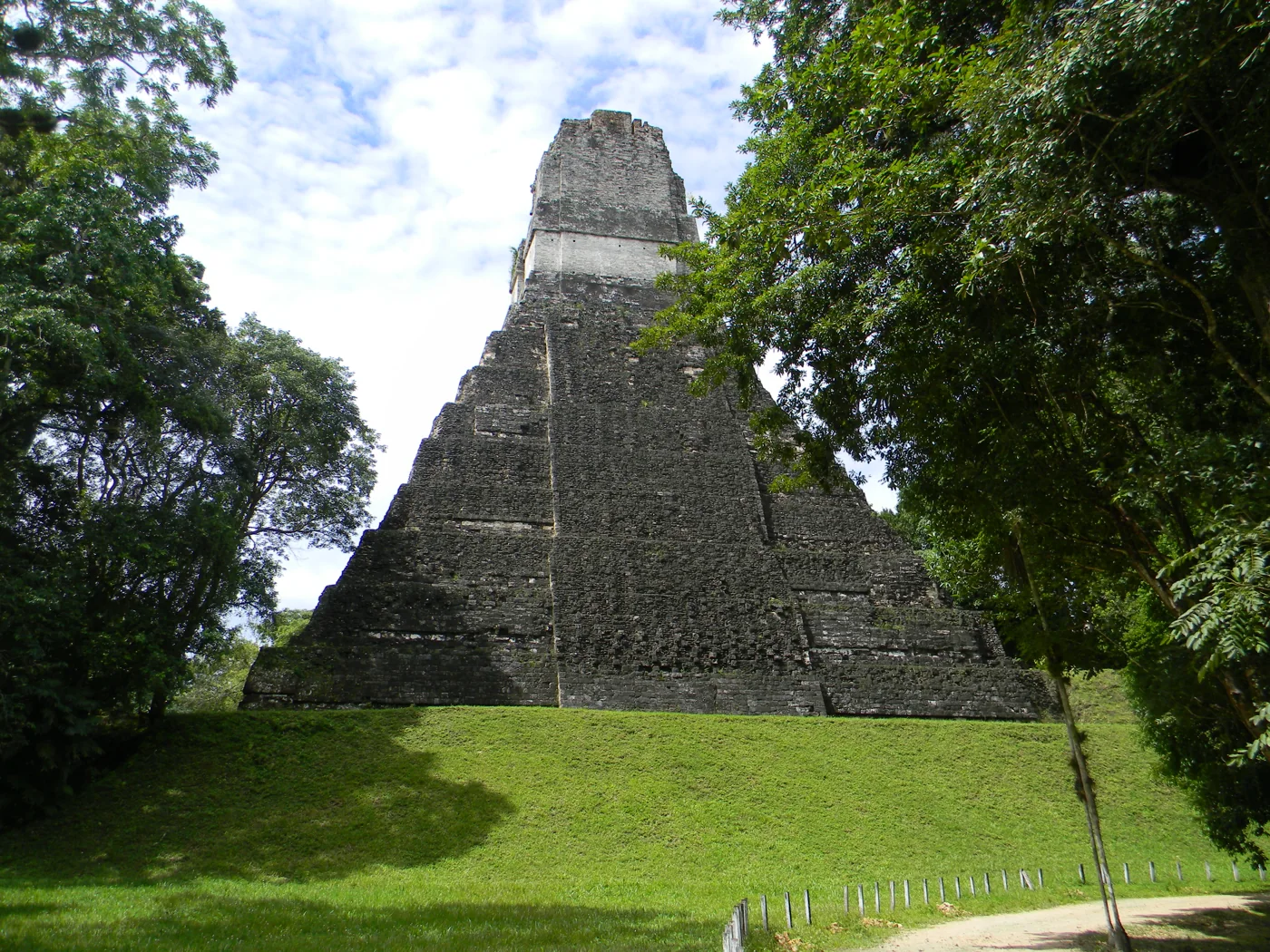
The steep stepped pyramid of Temple I at Tikal amid the forest.
Modern photograph. Tikal’s Temple I as it survives today, photographed in 2013. Photo: Laslovarga / Wikimedia Commons · CC BY-SA 3.0. Resized and converted to WebP.

By the Classic period, Maya politics centred on many royal courts. Tikal and Calakmul became powerful players in changing alliances and conflicts. Their monuments celebrate rulers and ceremonies, giving us the viewpoint of the court. Dress also expressed status. Women wore wrapped skirts and huipils, loose woven garments; men wore loincloths and mantles. Cotton and agave fibres became cloth through spinning and weaving, often on a backstrap loom held taut by the weaver’s body. Elaborate royal dress depended on skilled work that inscriptions seldom name. Beyond the monuments, reservoirs, fields and settlements supported the ceremonial centres. Forest around the ruins today can hide a landscape once actively managed by people. Temples expressed royal ambition, while cities depended on household work, water and food.

Historical dates and route context

A connected thematic history, not a single expedition or a map of one unified Maya empire. The opening date is an editorial anchor within the Late Preclassic; earlier history is described retrospectively. Most scene dates identify approximate periods, not exact construction, founding or abandonment days. Modern countries orient the viewer. Archaeological points represent public sites or broad urban contexts, not surveyed boundaries or sovereign territory. No region-wide population total is asserted. AI illustrations are labelled reconstructions or modern illustrations; imagined people, buildings and glyph details are not verified portraits, plans or readable historical records. Maya peoples and languages continue today.

Sources: UNESCO · Tikal National Park · UNESCO · Calakmul and its managed forest landscape · Centro de Textiles del Mundo Maya · clothing, materials and backstrap weaving · Photograph · original, author and licence · Photograph licence · CC BY-SA 3.0

Quiriguá · histories written in stone

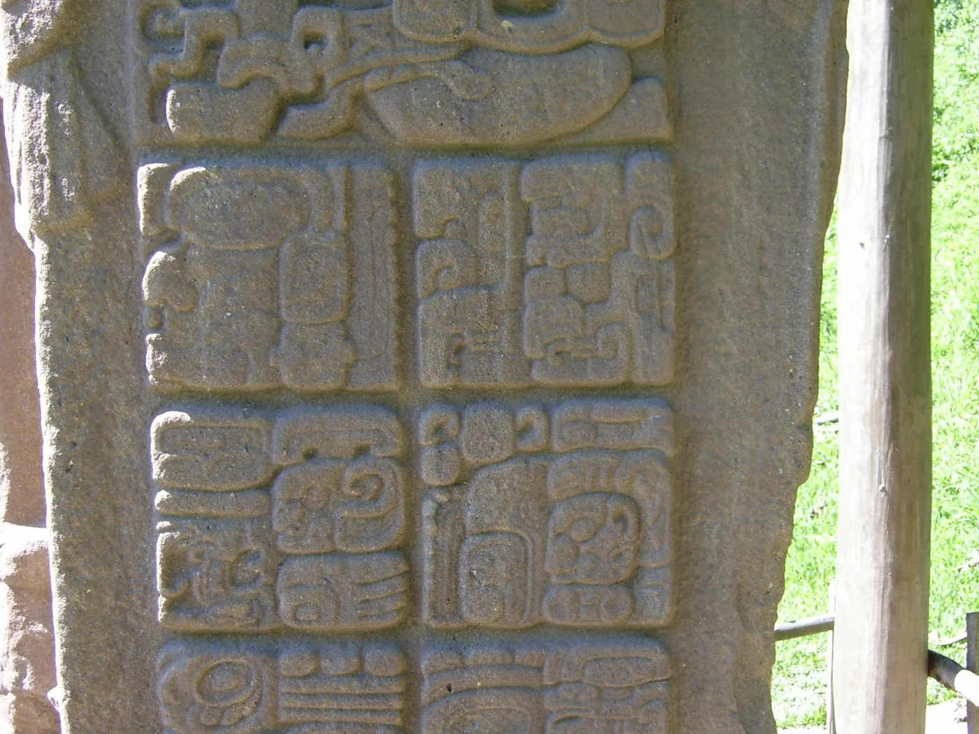
Carved Maya glyph blocks covering the side of Stela D at Quiriguá.
Modern photograph. A close view of real Maya inscriptions on Stela D at Quiriguá, photographed in modern times. Photo: Jan Pešula / Wikimedia Commons · CC BY-SA 2.5. Resized and converted to WebP.

At the Quirigua archaeological site, tall carved monuments bring rulers and dates together. Maya writing combines signs for words with signs for sounds, allowing specialists to record names, rituals and political events. Calendar dates place those accounts within linked cycles of time. Knowledge of the Sun, Moon and Venus also helped shape ceremonial and practical calendars. These achievements drew on traditions refined across many generations. Reading the inscriptions gives ancient people names and histories, while reminding us that rulers chose what their monuments would celebrate.

Historical dates and route context

A connected thematic history, not a single expedition or a map of one unified Maya empire. The opening date is an editorial anchor within the Late Preclassic; earlier history is described retrospectively. Most scene dates identify approximate periods, not exact construction, founding or abandonment days. Modern countries orient the viewer. Archaeological points represent public sites or broad urban contexts, not surveyed boundaries or sovereign territory. No region-wide population total is asserted. AI illustrations are labelled reconstructions or modern illustrations; imagined people, buildings and glyph details are not verified portraits, plans or readable historical records. Maya peoples and languages continue today.

Sources: UNESCO · Quiriguá carved monuments and historical texts · Smithsonian NMAI · Maya calendars and hieroglyphic writing · Photograph · original, author and licence · Photograph licence · CC BY-SA 2.5

Changing Maya worlds

Chichén Itzá · a changing political landscape

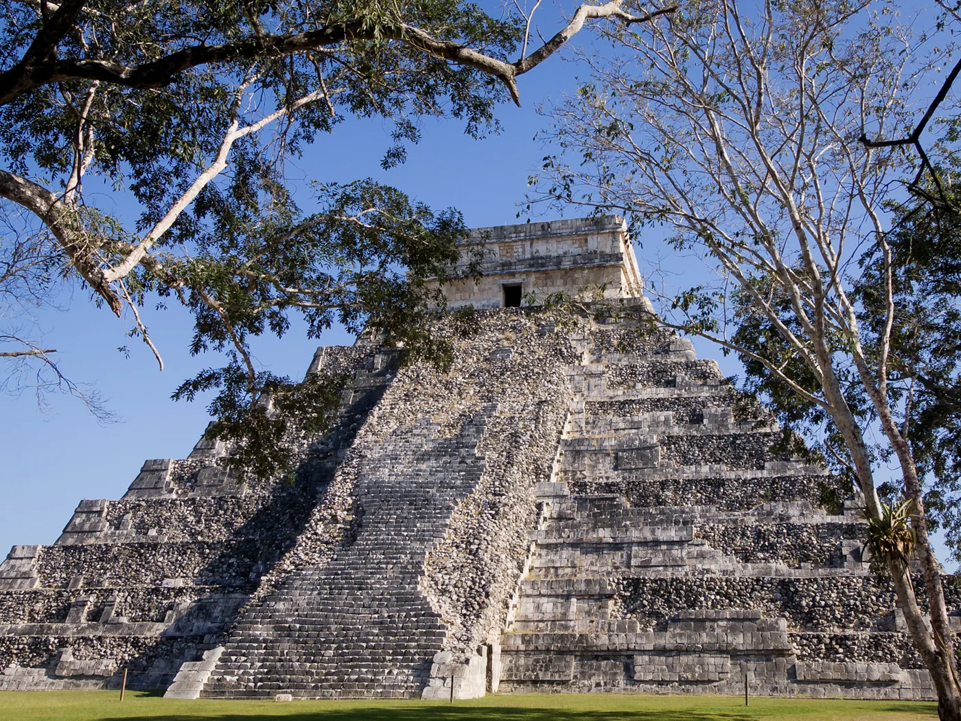
El Castillo’s stepped pyramid and central stairway at Chichén Itzá.
Modern photograph. El Castillo, the Temple of Kukulkan at Chichén Itzá, photographed in 2012; surviving and restored architecture. Photo: Ken Thomas / Wikimedia Commons · Public domain. Resized and converted to WebP.

Between roughly the eighth and tenth centuries, many southern lowland royal centres lost population and political power. The changes happened at different times and in different ways. Warfare, environmental pressures and problems sustaining political systems interacted; one simple cause cannot explain every place. Maya people did not disappear. In the northern peninsula, centres such as Chichen Itza became especially important. Its temples, public spaces and connections beyond the peninsula show a world still changing and exchanging ideas. The end of many Classic dynasties was a transformation within Maya history, not its final chapter.

Historical dates and route context

A connected thematic history, not a single expedition or a map of one unified Maya empire. The opening date is an editorial anchor within the Late Preclassic; earlier history is described retrospectively. Most scene dates identify approximate periods, not exact construction, founding or abandonment days. Modern countries orient the viewer. Archaeological points represent public sites or broad urban contexts, not surveyed boundaries or sovereign territory. No region-wide population total is asserted. AI illustrations are labelled reconstructions or modern illustrations; imagined people, buildings and glyph details are not verified portraits, plans or readable historical records. Maya peoples and languages continue today.

Sources: Turner and Sabloff, PNAS (2012) · Classic Maya political and environmental change · UNESCO · Chichén Itzá · Photograph · original, author and licence · Photograph licence · Public domain

Mayapán · trade, crowded households and fragile power

Illustrative view of Mayapán’s walled town, houses and temple around AD 1400.
AI-generated historical reconstruction. Illustrative walled Mayapán and everyday trade around AD 1400. People, buildings and layout are imagined, not a verified site plan or eyewitness record.

Later, Mayapan became a major northern centre. Inside its walls, houses, workshops and civic buildings brought many activities close together. Its main temple echoed forms familiar from Chichen Itza, while trade connected communities across the peninsula and its coasts. Political power remained contested. Research links the city’s fifteenth-century breakdown with interacting drought, food insecurity and factional violence. People dispersed and built lives elsewhere. The abandonment of an important capital could change regional politics profoundly without bringing Maya culture or local communities to an end.

Historical dates and route context

A connected thematic history, not a single expedition or a map of one unified Maya empire. The opening date is an editorial anchor within the Late Preclassic; earlier history is described retrospectively. Most scene dates identify approximate periods, not exact construction, founding or abandonment days. Modern countries orient the viewer. Archaeological points represent public sites or broad urban contexts, not surveyed boundaries or sovereign territory. No region-wide population total is asserted. AI illustrations are labelled reconstructions or modern illustrations; imagined people, buildings and glyph details are not verified portraits, plans or readable historical records. Maya peoples and languages continue today.

Sources: INAH Yucatán · Mayapán chronology and architecture · Kennett and colleagues, Nature Communications (2022) · Mayapán conflict and resilience

Invasion and endurance

Iximche · alliances and colonial invasion

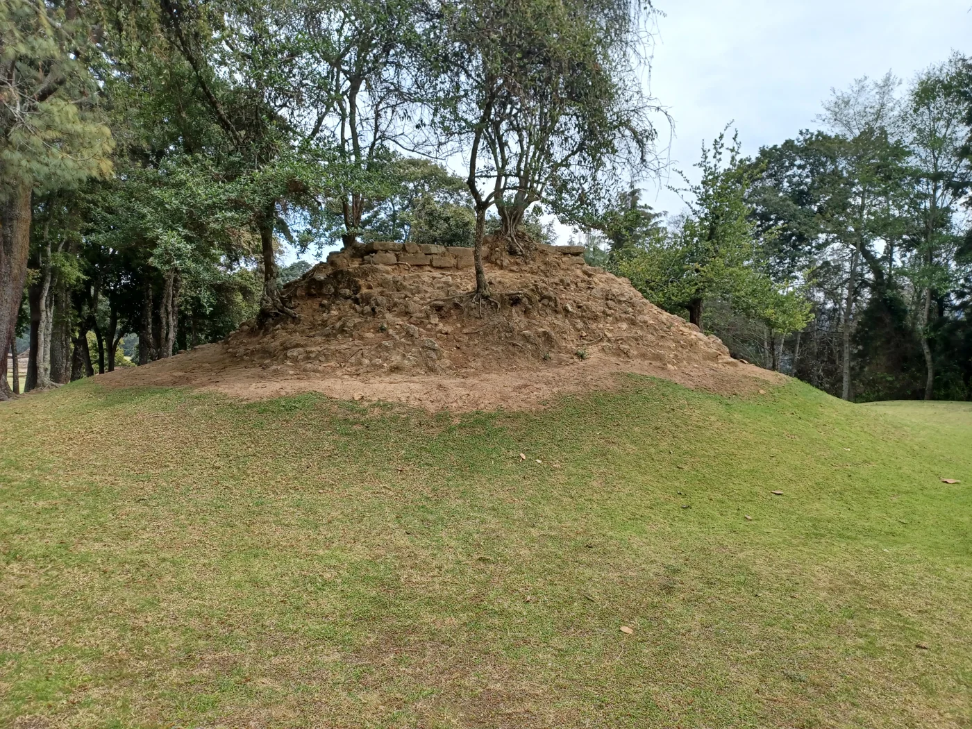
Low stone platform and grassy plaza among trees at Iximche.
Modern photograph. Surviving remains at Iximche, the former Kaqchikel capital and a continuing sacred site, photographed in 2022. Photo: Simon Burchell / Wikimedia Commons · CC BY-SA 4.0. Resized and converted to WebP.

In the highlands, the Kaqchikel capital of Iximche belonged to another Maya political world. When Spanish forces entered the region in fifteen twenty-four, existing rivalries shaped the encounter. Some Kaqchikel leaders initially allied with the newcomers against their opponents. That alliance did not protect them from colonial demands, conflict and destruction. Conquest was made through Indigenous decisions and resistance as well as Spanish military action, under deeply unequal conditions. The archaeological site preserves plazas and ball courts, but it is also a living sacred place where Maya communities continue to hold ceremonies.

Historical dates and route context

A connected thematic history, not a single expedition or a map of one unified Maya empire. The opening date is an editorial anchor within the Late Preclassic; earlier history is described retrospectively. Most scene dates identify approximate periods, not exact construction, founding or abandonment days. Modern countries orient the viewer. Archaeological points represent public sites or broad urban contexts, not surveyed boundaries or sovereign territory. No region-wide population total is asserted. AI illustrations are labelled reconstructions or modern illustrations; imagined people, buildings and glyph details are not verified portraits, plans or readable historical records. Maya peoples and languages continue today.

Sources: Guatemala CONAP · Iximche archaeological and living sacred site · Edgar Esquit Choy, USAC · Kaqchikel communal territories under colonial domination · Comité de Unidad Campesina · Maya alliances and resistance in Guatemala’s history · Photograph · original, author and licence · Photograph licence · CC BY-SA 4.0

Nojpetén · an independent capital survives until 1697

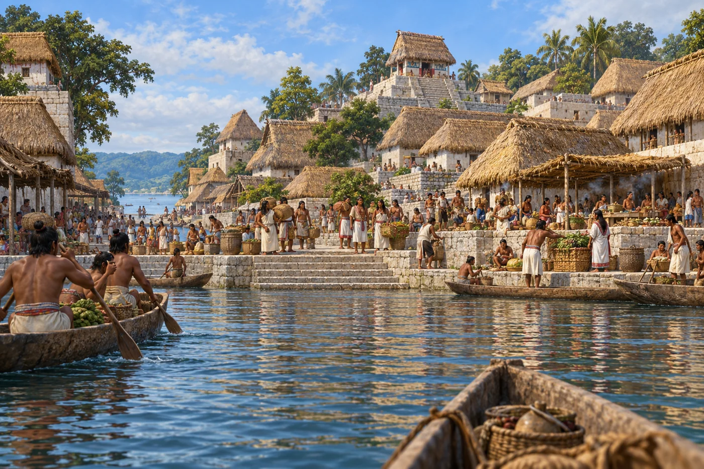
Imagined canoe approach to the populated lakefront of Nojpetén before the 1697 conquest.
AI-generated historical reconstruction. Illustrative canoe approach to Nojpetén’s lakefront around AD 1697, before Spanish conquest. People, buildings and waterfront layout are imagined, not a verified city plan or eyewitness record.

Spanish invasion did not take every Maya kingdom at once. On Lake Peten Itza, the island capital of Nojpeten remained outside Spanish control long after the first encounters. Itza leaders dealt with visitors, missionaries and threats within a changing regional world. On the thirteenth of March, sixteen ninety-seven, Spanish forces attacked and occupied the capital. The event ended this independent political centre, but not Maya society. Across the region, colonial violence and imposed rule reshaped lives; people also defended communities, adapted practices and carried their languages and knowledge forward.

Historical dates and route context

A connected thematic history, not a single expedition or a map of one unified Maya empire. The opening date is an editorial anchor within the Late Preclassic; earlier history is described retrospectively. Most scene dates identify approximate periods, not exact construction, founding or abandonment days. Modern countries orient the viewer. Archaeological points represent public sites or broad urban contexts, not surveyed boundaries or sovereign territory. No region-wide population total is asserted. AI illustrations are labelled reconstructions or modern illustrations; imagined people, buildings and glyph details are not verified portraits, plans or readable historical records. Maya peoples and languages continue today.

Sources: Proyecto Arqueológico Tayasal · 2010 field report and Itza documentary context · Edgar Esquit Choy, USAC · Kaqchikel communal territories under colonial domination

Living histories

Living Maya histories · more than a vanished past

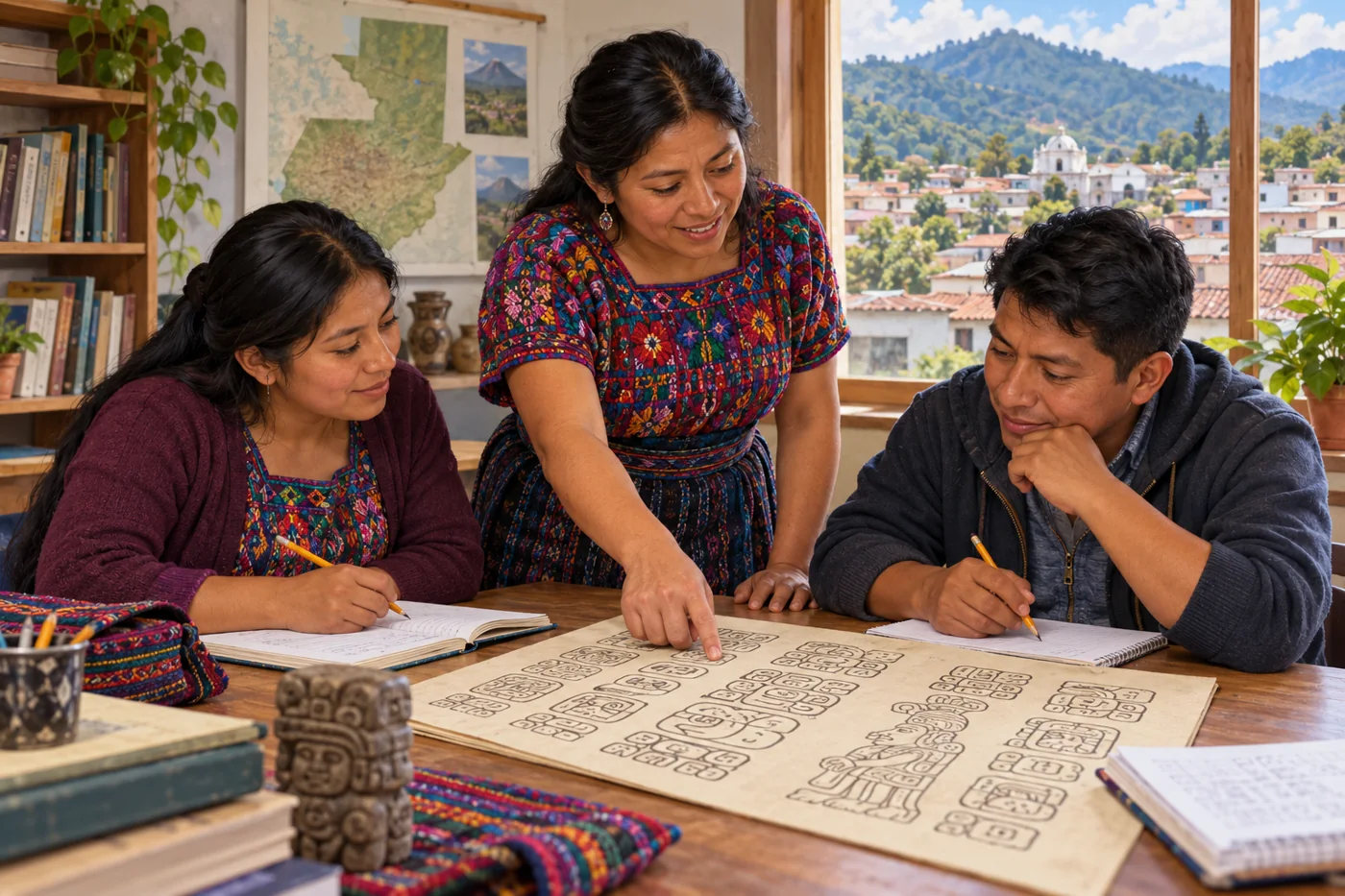
An imagined modern Maya teacher and adult students studying illustrated glyphs in Guatemala.
AI-generated modern cultural illustration. An anonymous Maya teacher and adult students in an imagined Guatemalan classroom. People and setting are not verified portraits or a documented event; glyph illustrations are not a scholarly transcription.

Maya history continues in homes, farms, classrooms, museums and public life. People speak many Maya languages, preserve and reshape traditions, and help study and interpret the past. In many communities, women wear huipils and skirts whose designs express local identities. Weavers sustain old skills while choosing new materials and creating new designs; today’s clothing has its own history of change. Archaeologists work with evidence from buildings and landscapes, while communities bring knowledge and questions of their own. Together, these places reveal a long history of cultivation, belief, conflict and renewal. Ancient cities matter most when we understand the people who sustained them, and recognize the Maya who are here today.

Historical dates and route context

A connected thematic history, not a single expedition or a map of one unified Maya empire. The opening date is an editorial anchor within the Late Preclassic; earlier history is described retrospectively. Most scene dates identify approximate periods, not exact construction, founding or abandonment days. Modern countries orient the viewer. Archaeological points represent public sites or broad urban contexts, not surveyed boundaries or sovereign territory. No region-wide population total is asserted. AI illustrations are labelled reconstructions or modern illustrations; imagined people, buildings and glyph details are not verified portraits, plans or readable historical records. Maya peoples and languages continue today.

Sources: Smithsonian NMAI · the Maya people · Smithsonian NMAI · living Maya perspectives · Smithsonian NMAI · corn and Maya time · Centro de Textiles del Mundo Maya · clothing, materials and backstrap weaving